Clayes
Clayes
Kloued | |
|---|---|
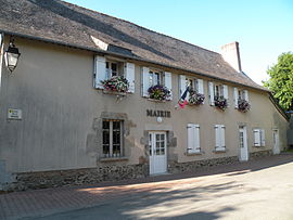 Town hall | |
 Coat of arms | |
show Location of Clayes | |
 Clayes | |
| Coordinates: 48°10′39″N 1°51′05″W / 48.1775°N 1.8514°WCoordinates: 48°10′39″N 1°51′05″W / 48.1775°N 1.8514°W | |
| Country | France |
| Region | Brittany |
| Department | Ille-et-Vilaine |
| Arrondissement | Rennes |
| Canton | Melesse |
| Intercommunality | Rennes Métropole |
| Government | |
| • Mayor (2020–2026) | Philippe Sicot |
| Area 1 | 4.28 km2 (1.65 sq mi) |
| Population (Jan. 2018)[1] | 906 |
| • Density | 210/km2 (550/sq mi) |
| Time zone | UTC+01:00 (CET) |
| • Summer (DST) | UTC+02:00 (CEST) |
| INSEE/Postal code | 35081 /35590 |
| Elevation | 65–109 m (213–358 ft) |
| 1 French Land Register data, which excludes lakes, ponds, glaciers > 1 km2 (0.386 sq mi or 247 acres) and river estuaries. | |


Clayes (Breton: Kloued, Gallo: Claès) is a commune in the Ille-et-Vilaine department in Brittany in northwestern France.
Population[]
Inhabitants of Clayes are called Clayens in French.
| Year | Pop. | ±% |
|---|---|---|
| 1962 | 190 | — |
| 1968 | 178 | −6.3% |
| 1975 | 256 | +43.8% |
| 1982 | 403 | +57.4% |
| 1990 | 401 | −0.5% |
| 1999 | 459 | +14.5% |
| 2008 | 694 | +51.2% |
| 2015 | 818 | +17.9% |
See also[]
- Communes of the Ille-et-Vilaine department
References[]
- ^ "Populations légales 2018". INSEE. 28 December 2020.
External links[]
| Wikimedia Commons has media related to Clayes. |
- Base Mérimée: Search for heritage in the commune, Ministère français de la Culture. (in French)
- Mayors of Ille-et-Vilaine Association (in French)
| show Communes of the Ille-et-Vilaine department |
|---|
This Ille-et-Vilaine geographical article is a stub. You can help Wikipedia by . |
Categories:
- Communes of Ille-et-Vilaine
- Ille-et-Vilaine geography stubs