Comblessac
Comblessac
Kamlec'hieg | |
|---|---|
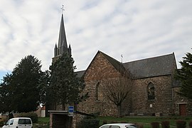 The church of Saint-Éloi | |
show Location of Comblessac | |
 Comblessac | |
| Coordinates: 47°52′38″N 2°04′58″W / 47.8772°N 2.0828°WCoordinates: 47°52′38″N 2°04′58″W / 47.8772°N 2.0828°W | |
| Country | France |
| Region | Brittany |
| Department | Ille-et-Vilaine |
| Arrondissement | Redon |
| Canton | Guichen |
| Intercommunality | Vallons de Haute-Bretagne |
| Government | |
| • Mayor (2014–2020) | Robert Perrot |
| Area 1 | 17.23 km2 (6.65 sq mi) |
| Population (Jan. 2018)[1] | 690 |
| • Density | 40/km2 (100/sq mi) |
| Time zone | UTC+01:00 (CET) |
| • Summer (DST) | UTC+02:00 (CEST) |
| INSEE/Postal code | 35084 /35330 |
| Elevation | 17–96 m (56–315 ft) |
| 1 French Land Register data, which excludes lakes, ponds, glaciers > 1 km2 (0.386 sq mi or 247 acres) and river estuaries. | |


Comblessac (Breton: Kamlec'hieg) is a commune in the Ille-et-Vilaine department of Brittany in northwestern France.
Population[]
Inhabitants of Comblessac are called Comblessacois in French.
| Year | Pop. | ±% |
|---|---|---|
| 1962 | 521 | — |
| 1968 | 581 | +11.5% |
| 1975 | 535 | −7.9% |
| 1982 | 489 | −8.6% |
| 1990 | 497 | +1.6% |
| 1999 | 487 | −2.0% |
| 2008 | 640 | +31.4% |
See also[]
- Communes of the Ille-et-Vilaine department
References[]
- ^ "Populations légales 2018". INSEE. 28 December 2020.
External links[]
| Wikimedia Commons has media related to Comblessac. |
- Base Mérimée: Search for heritage in the commune, Ministère français de la Culture. (in French)
- Mayors of Ille-et-Vilaine Association (in French)
| show Communes of the Ille-et-Vilaine department |
|---|
This Ille-et-Vilaine geographical article is a stub. You can help Wikipedia by . |
Categories:
- Communes of Ille-et-Vilaine
- Ille-et-Vilaine geography stubs