Sougéal
Sougéal
Sulial | |
|---|---|
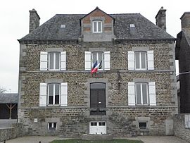 The town hall of Sougéal | |
show Location of Sougéal | |
 Sougéal | |
| Coordinates: 48°30′38″N 1°31′18″W / 48.5106°N 1.5217°WCoordinates: 48°30′38″N 1°31′18″W / 48.5106°N 1.5217°W | |
| Country | France |
| Region | Brittany |
| Department | Ille-et-Vilaine |
| Arrondissement | Saint-Malo |
| Canton | Dol-de-Bretagne |
| Government | |
| • Mayor (2020–2026) | Rémi Chapdelaine[1] |
| Area 1 | 14.15 km2 (5.46 sq mi) |
| Population (Jan. 2018)[2] | 558 |
| • Density | 39/km2 (100/sq mi) |
| Time zone | UTC+01:00 (CET) |
| • Summer (DST) | UTC+02:00 (CEST) |
| INSEE/Postal code | 35329 /35610 |
| Elevation | 5–104 m (16–341 ft) |
| 1 French Land Register data, which excludes lakes, ponds, glaciers > 1 km2 (0.386 sq mi or 247 acres) and river estuaries. | |


Sougéal (Breton: Sulial, Gallo: Soujau) is a commune in the Ille-et-Vilaine department in Brittany in northwestern France.
Population[]
Inhabitants of Sougéal are called Sougelais in French.
| Year | Pop. | ±% |
|---|---|---|
| 1962 | 642 | — |
| 1968 | 703 | +9.5% |
| 1975 | 687 | −2.3% |
| 1982 | 618 | −10.0% |
| 1990 | 626 | +1.3% |
| 1999 | 586 | −6.4% |
| 2009 | 638 | +8.9% |
See also[]
- Communes of the Ille-et-Vilaine department
References[]
- ^ "Répertoire national des élus: les maires". data.gouv.fr, Plateforme ouverte des données publiques françaises (in French). 2 December 2020.
- ^ "Populations légales 2018". INSEE. 28 December 2020.
External links[]
| Wikimedia Commons has media related to Sougéal. |
- Mayors of Ille-et-Vilaine Association (in French)
| show Communes of the Ille-et-Vilaine department |
|---|
This Ille-et-Vilaine geographical article is a stub. You can help Wikipedia by . |
Categories:
- Communes of Ille-et-Vilaine
- Ille-et-Vilaine geography stubs