Mondevert
Mondevert
Mondeverzh | |
|---|---|
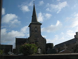 The church of Sainte-Marie-Madeleine | |
show Location of Mondevert | |
 Mondevert | |
| Coordinates: 48°05′06″N 1°05′52″W / 48.0850°N 1.0978°WCoordinates: 48°05′06″N 1°05′52″W / 48.0850°N 1.0978°W | |
| Country | France |
| Region | Brittany |
| Department | Ille-et-Vilaine |
| Arrondissement | Fougères-Vitré |
| Canton | Vitré |
| Intercommunality | CA Vitré Communauté |
| Government | |
| • Mayor (2020–2026) | Christian Stéphan[1] |
| Area 1 | 5.02 km2 (1.94 sq mi) |
| Population (Jan. 2018)[2] | 820 |
| • Density | 160/km2 (420/sq mi) |
| Time zone | UTC+01:00 (CET) |
| • Summer (DST) | UTC+02:00 (CEST) |
| INSEE/Postal code | 35183 /35370 |
| Elevation | 107–142 m (351–466 ft) |
| 1 French Land Register data, which excludes lakes, ponds, glaciers > 1 km2 (0.386 sq mi or 247 acres) and river estuaries. | |


Mondevert (Breton: Mondeverzh, Gallo: Mondevèrt) is a commune in the Ille-et-Vilaine department of Brittany in northwestern France.
Population[]
Inhabitants of Mondevert are called Mondevertais in French.
| Year | Pop. | ±% |
|---|---|---|
| 1962 | 304 | — |
| 1968 | 315 | +3.6% |
| 1975 | 318 | +1.0% |
| 1982 | 357 | +12.3% |
| 1990 | 458 | +28.3% |
| 1999 | 576 | +25.8% |
| 2008 | 775 | +34.5% |
See also[]
- Communes of the Ille-et-Vilaine department
References[]
- ^ "Répertoire national des élus: les maires". data.gouv.fr, Plateforme ouverte des données publiques françaises (in French). 2 December 2020.
- ^ "Populations légales 2018". INSEE. 28 December 2020.
External links[]
| Wikimedia Commons has media related to Mondevert. |
- Base Mérimée: Search for heritage in the commune, Ministère français de la Culture. (in French)
- Mayors of Ille-et-Vilaine Association (in French)
| show Communes of the Ille-et-Vilaine department |
|---|
This Ille-et-Vilaine geographical article is a stub. You can help Wikipedia by . |
Categories:
- Communes of Ille-et-Vilaine
- Ille-et-Vilaine geography stubs