Dingé
Dingé | |
|---|---|
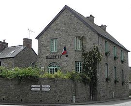 Town hall | |
show Location of Dingé | |
 Dingé | |
| Coordinates: 48°21′29″N 1°42′53″W / 48.3581°N 1.7147°WCoordinates: 48°21′29″N 1°42′53″W / 48.3581°N 1.7147°W | |
| Country | France |
| Region | Brittany |
| Department | Ille-et-Vilaine |
| Arrondissement | Rennes |
| Canton | Combourg |
| Intercommunality | Bretagne Romantique |
| Government | |
| • Mayor (2014–2020) | Rémi Bourges |
| Area 1 | 52.89 km2 (20.42 sq mi) |
| Population (Jan. 2018)[1] | 1,633 |
| • Density | 31/km2 (80/sq mi) |
| Time zone | UTC+01:00 (CET) |
| • Summer (DST) | UTC+02:00 (CEST) |
| INSEE/Postal code | 35094 /35440 |
| Elevation | 54–108 m (177–354 ft) |
| 1 French Land Register data, which excludes lakes, ponds, glaciers > 1 km2 (0.386 sq mi or 247 acres) and river estuaries. | |


Dingé (Gallo: Deinjaé) is a commune in the Ille-et-Vilaine department in Brittany in northwestern France.
Demographics[]
Inhabitants of Dingé are called Dingéens in French.
| Year | Pop. | ±% |
|---|---|---|
| 1962 | 1,360 | — |
| 1968 | 1,436 | +5.6% |
| 1975 | 1,259 | −12.3% |
| 1982 | 1,268 | +0.7% |
| 1990 | 1,265 | −0.2% |
| 1999 | 1,327 | +4.9% |
| 2008 | 1,543 | +16.3% |
Twin towns[]
 Stio (Italy)
See also[]
- Communes of the Ille-et-Vilaine department
References[]
- ^ "Populations légales 2018". INSEE. 28 December 2020.
- (in French) Mayors of Ille-et-Vilaine Association
External links[]
| Wikimedia Commons has media related to Dingé. |
- (in French) Cultural Heritage
| show Communes of the Ille-et-Vilaine department |
|---|
| show Authority control |
|---|
This Ille-et-Vilaine geographical article is a stub. You can help Wikipedia by . |
Categories:
- Communes of Ille-et-Vilaine
- Ille-et-Vilaine geography stubs