Epiniac
Epiniac
Sperneg | |
|---|---|
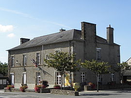 Town hall | |
 Coat of arms | |
show Location of Epiniac | |
 Epiniac | |
| Coordinates: 48°30′39″N 1°41′41″W / 48.5108°N 1.6947°WCoordinates: 48°30′39″N 1°41′41″W / 48.5108°N 1.6947°W | |
| Country | France |
| Region | Brittany |
| Department | Ille-et-Vilaine |
| Arrondissement | Saint-Malo |
| Canton | Dol-de-Bretagne |
| Government | |
| ��� Mayor (2020–2026) | Sylvie Ramé-Prunaux[1] |
| Area 1 | 23.77 km2 (9.18 sq mi) |
| Population (Jan. 2018)[2] | 1,422 |
| • Density | 60/km2 (150/sq mi) |
| Time zone | UTC+01:00 (CET) |
| • Summer (DST) | UTC+02:00 (CEST) |
| INSEE/Postal code | 35104 /35120 |
| Elevation | 11–107 m (36–351 ft) |
| 1 French Land Register data, which excludes lakes, ponds, glaciers > 1 km2 (0.386 sq mi or 247 acres) and river estuaries. | |


Epiniac[3] (French pronunciation: [epinjak]; Breton: Sperneg; Gallo: Espeinyac) is a commune in the Ille-et-Vilaine department in Brittany in northwestern France.
Population[]
Inhabitants of Epiniac are called Epiniacais in French.
| Year | Pop. | ±% |
|---|---|---|
| 1962 | 1,004 | — |
| 1968 | 1,126 | +12.2% |
| 1975 | 1,064 | −5.5% |
| 1982 | 1,104 | +3.8% |
| 1990 | 1,105 | +0.1% |
| 1999 | 1,078 | −2.4% |
| 2008 | 1,345 | +24.8% |
Gallery[]

Saint Léonard church

Saint Pierre church


See also[]
- Communes of the Ille-et-Vilaine department
References[]
- ^ "Répertoire national des élus: les maires". data.gouv.fr, Plateforme ouverte des données publiques françaises (in French). 2 December 2020.
- ^ "Populations légales 2018". INSEE. 28 December 2020.
- ^ Commune d’Epiniac (35104), INSEE
External links[]
| Wikimedia Commons has media related to Epiniac. |
- Base Mérimée: Search for heritage in the commune, Ministère français de la Culture. (in French)
- Mayors of Ille-et-Vilaine Association (in French)
| show Communes of the Ille-et-Vilaine department |
|---|
This Ille-et-Vilaine geographical article is a stub. You can help Wikipedia by . |
Categories:
- Communes of Ille-et-Vilaine
- Ille-et-Vilaine geography stubs