Essé
Essé
Ezieg | |
|---|---|
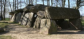 La Roche-aux-Fées, a dolmen | |
show Location of Essé | |
 Essé | |
| Coordinates: 47°57′30″N 1°25′24″W / 47.9583°N 1.4233°WCoordinates: 47°57′30″N 1°25′24″W / 47.9583°N 1.4233°W | |
| Country | France |
| Region | Brittany |
| Department | Ille-et-Vilaine |
| Arrondissement | Fougères-Vitré |
| Canton | La Guerche-de-Bretagne |
| Intercommunality | Roche-aux-Fées |
| Government | |
| • Mayor (2020–2026) | Joseph Geslin[1] |
| Area 1 | 23.19 km2 (8.95 sq mi) |
| Population (Jan. 2018)[2] | 1,077 |
| • Density | 46/km2 (120/sq mi) |
| Time zone | UTC+01:00 (CET) |
| • Summer (DST) | UTC+02:00 (CEST) |
| INSEE/Postal code | 35108 /35150 |
| Elevation | 32–92 m (105–302 ft) |
| 1 French Land Register data, which excludes lakes, ponds, glaciers > 1 km2 (0.386 sq mi or 247 acres) and river estuaries. | |


Essé (French pronunciation: [ese]; Breton: Ezieg) is a commune in the Ille-et-Vilaine department in Brittany in northwestern France.
Population[]
Inhabitants of Essé are called Esséens in French.
| Year | Pop. | ±% |
|---|---|---|
| 1962 | 781 | — |
| 1968 | 831 | +6.4% |
| 1975 | 729 | −12.3% |
| 1982 | 747 | +2.5% |
| 1990 | 816 | +9.2% |
| 1999 | 848 | +3.9% |
| 2008 | 1,107 | +30.5% |
See also[]
- Communes of the Ille-et-Vilaine department
References[]
- ^ "Répertoire national des élus: les maires". data.gouv.fr, Plateforme ouverte des données publiques françaises (in French). 2 December 2020.
- ^ "Populations légales 2018". INSEE. 28 December 2020.
External links[]
| Wikimedia Commons has media related to Essé. |
- Base Mérimée: Search for heritage in the commune, Ministère français de la Culture. (in French)
- Mayors of Ille-et-Vilaine Association (in French)
| show Communes of the Ille-et-Vilaine department |
|---|
This Ille-et-Vilaine geographical article is a stub. You can help Wikipedia by . |
Categories:
- Communes of Ille-et-Vilaine
- Ille-et-Vilaine geography stubs