Sains, Ille-et-Vilaine
show This article may be expanded with text translated from the corresponding article in French. (June 2020) Click [show] for important translation instructions. |
Sains
Sent | |
|---|---|
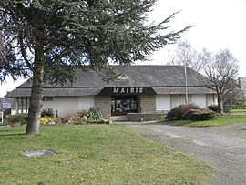 The town hall of Sains | |
show Location of Sains | |
 Sains | |
| Coordinates: 48°33′07″N 1°34′59″W / 48.5519°N 1.5831°WCoordinates: 48°33′07″N 1°34′59″W / 48.5519°N 1.5831°W | |
| Country | France |
| Region | Brittany |
| Department | Ille-et-Vilaine |
| Arrondissement | Saint-Malo |
| Canton | Dol-de-Bretagne |
| Intercommunality | Pays de Dol et Baie du Mont Saint-Michel |
| Government | |
| • Mayor (2014–2020) | Michel Blin |
| Area 1 | 10.25 km2 (3.96 sq mi) |
| Population (Jan. 2018)[1] | 471 |
| • Density | 46/km2 (120/sq mi) |
| Time zone | UTC+01:00 (CET) |
| • Summer (DST) | UTC+02:00 (CEST) |
| INSEE/Postal code | 35248 /35610 |
| Elevation | 19–96 m (62–315 ft) |
| 1 French Land Register data, which excludes lakes, ponds, glaciers > 1 km2 (0.386 sq mi or 247 acres) and river estuaries. | |


Sains (Breton: Sent) is a commune in the Ille-et-Vilaine department in Brittany in northwestern France.
Population[]
| Year | Pop. | ±% |
|---|---|---|
| 1962 | 543 | — |
| 1968 | 569 | +4.8% |
| 1975 | 628 | +10.4% |
| 1982 | 667 | +6.2% |
| 1990 | 569 | −14.7% |
| 1999 | 504 | −11.4% |
| 2009 | 483 | −4.2% |
Inhabitants of Sains are called sainsois in French.
Geography[]

St Peter's church
- The Église Saint-Pierre is in the Gothic revival style; it was mainly built between 1861 and 1868 by Jean-Gabriel Frangeul to the designs of . The tower and spire are the work of Alfred-Louis Frangeul (his son), 1893-1894.[2][3]
- The Étang du Bourg, a mesotrophic pond[4]
See also[]
- Communes of the Ille-et-Vilaine department
References[]
- ^ "Populations légales 2018". INSEE. 28 December 2020.
- ^ Véronique Orain (ed.), Ille-et-Vilaine. Églises et chapelles. Rennes: Service de l'Inventaire, Indicateurs du Patrimoine, 1996; p. 236
- ^ Mérimée
- ^ Louis Diard, La flore d'Ille-et-Vilaine, Atlas floristique de Bretagne. Rennes: Siloë, 2005; p. 64.
External links[]
![]() Media related to Sains (Ille-et-Vilaine) at Wikimedia Commons
Media related to Sains (Ille-et-Vilaine) at Wikimedia Commons
- Mayors of Ille-et-Vilaine Association (in French)
| show Communes of the Ille-et-Vilaine department |
|---|
This Ille-et-Vilaine geographical article is a stub. You can help Wikipedia by . |
Categories:
- Communes of Ille-et-Vilaine
- Ille-et-Vilaine geography stubs