Boistrudan
Boistrudan | |
|---|---|
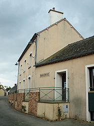 The town hall of Boistrudan | |
show Location of Boistrudan | |
 Boistrudan | |
| Coordinates: 47°58′13″N 1°23′59″W / 47.9703°N 1.3997°WCoordinates: 47°58′13″N 1°23′59″W / 47.9703°N 1.3997°W | |
| Country | France |
| Region | Brittany |
| Department | Ille-et-Vilaine |
| Arrondissement | Fougères-Vitré |
| Canton | Châteaugiron |
| Intercommunality | Roche-aux-Fées |
| Government | |
| • Mayor (2020–2026) | Anne Renault[1] |
| Area 1 | 12.80 km2 (4.94 sq mi) |
| Population (Jan. 2018)[2] | 708 |
| • Density | 55/km2 (140/sq mi) |
| Time zone | UTC+01:00 (CET) |
| • Summer (DST) | UTC+02:00 (CEST) |
| INSEE/Postal code | 35028 /35150 |
| Elevation | 32–85 m (105–279 ft) |
| 1 French Land Register data, which excludes lakes, ponds, glaciers > 1 km2 (0.386 sq mi or 247 acres) and river estuaries. | |


Boistrudan (French pronunciation: [bwatʁydɑ̃]; Breton: Koetruzan; Gallo: Boéz-Trudan) is a commune in the Ille-et-Vilaine department in Brittany in northwestern France.
Population[]
| Year | Pop. | ±% |
|---|---|---|
| 1962 | 546 | — |
| 1968 | 576 | +5.5% |
| 1975 | 505 | −12.3% |
| 1982 | 475 | −5.9% |
| 1990 | 501 | +5.5% |
| 1999 | 494 | −1.4% |
| 2009 | 673 | +36.2% |
Inhabitants of Boistrudan are called Boistrudanais in French.
Toponymy[]
Bosco Truant in 1197,[3] Boays-Trudant in the 16th century, then Bois-Trudain in 1685, Bois-trudaine around 1780.
Meaning : Truant's wood, Truant can be a surname or the common word for "beggar, tramp" in Old French.
See also[]
- Communes of the Ille-et-Vilaine department
References[]
- ^ "Répertoire national des élus: les maires". data.gouv.fr, Plateforme ouverte des données publiques françaises (in French). 2 December 2020.
- ^ "Populations légales 2018". INSEE. 28 December 2020.
- ^ Site of Kerofis (French/Breton)
External links[]
| Wikimedia Commons has media related to Boistrudan. |
- Official website (in French)
- Mayors of Ille-et-Vilaine Association (in French)

Panorama of the commune
| show Communes of the Ille-et-Vilaine department |
|---|
This Ille-et-Vilaine geographical article is a stub. You can help Wikipedia by . |
Categories:
- Communes of Ille-et-Vilaine
- Ille-et-Vilaine geography stubs