Bouzigues
Bouzigues | |
|---|---|
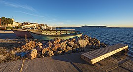 Shore of the Étang de Thau | |
 Coat of arms | |
show Location of Bouzigues | |
 Bouzigues | |
| Coordinates: 43°26′57″N 3°39′32″E / 43.4492°N 3.6589°ECoordinates: 43°26′57″N 3°39′32″E / 43.4492°N 3.6589°E | |
| Country | France |
| Region | Occitanie |
| Department | Hérault |
| Arrondissement | Montpellier |
| Canton | Mèze |
| Intercommunality | CA Sète Agglopôle Méditerranée |
| Government | |
| • Mayor (2020–2026) | Cédric Raja |
| Area 1 | 3.05 km2 (1.18 sq mi) |
| Population (Jan. 2018)[1] | 1,650 |
| • Density | 540/km2 (1,400/sq mi) |
| Time zone | UTC+01:00 (CET) |
| • Summer (DST) | UTC+02:00 (CEST) |
| INSEE/Postal code | 34039 /34140 |
| Elevation | 0–61 m (0–200 ft) (avg. 5 m or 16 ft) |
| 1 French Land Register data, which excludes lakes, ponds, glaciers > 1 km2 (0.386 sq mi or 247 acres) and river estuaries. | |


Bouzigues (French pronunciation: [buziɡ]; Bosigas in Occitan) is a commune in the Hérault department in southern France.

Map

The village and the Étang de Thau
Population[]
| Year | Pop. | ±% |
|---|---|---|
| 1962 | 767 | — |
| 1968 | 830 | +8.2% |
| 1975 | 904 | +8.9% |
| 1982 | 945 | +4.5% |
| 1990 | 907 | −4.0% |
| 1999 | 1,208 | +33.2% |
| 2008 | 1,536 | +27.2% |
See also[]
References[]
| Wikivoyage has a travel guide for Bouzigues. |
- ^ "Populations légales 2018". INSEE. 28 December 2020.
| Wikimedia Commons has media related to Bouzigues. |
This Hérault geographical article is a stub. You can help Wikipedia by . |
Categories:
- Communes of Hérault
- Hérault geography stubs