Cazevieille
Cazevieille | |
|---|---|
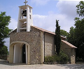 Church | |
 Coat of arms | |
show Location of Cazevieille | |
 Cazevieille | |
| Coordinates: 43°46′15″N 3°47′22″E / 43.7708°N 3.7894°ECoordinates: 43°46′15″N 3°47′22″E / 43.7708°N 3.7894°E | |
| Country | France |
| Region | Occitanie |
| Department | Hérault |
| Arrondissement | Lodève |
| Canton | Saint-Gély-du-Fesc |
| Government | |
| • Mayor (2020–2026) | Jean Vallon[1] |
| Area 1 | 16.21 km2 (6.26 sq mi) |
| Population (Jan. 2018)[2] | 200 |
| • Density | 12/km2 (32/sq mi) |
| Time zone | UTC+01:00 (CET) |
| • Summer (DST) | UTC+02:00 (CEST) |
| INSEE/Postal code | 34066 /34270 |
| Elevation | 160–658 m (525–2,159 ft) |
| 1 French Land Register data, which excludes lakes, ponds, glaciers > 1 km2 (0.386 sq mi or 247 acres) and river estuaries. | |


Cazevieille (French pronunciation: [kazvjɛj]; Occitan: Casavièlha) is a commune in the Hérault department in southern France.

Map
Population[]
| Year | Pop. | ±% |
|---|---|---|
| 1962 | 31 | — |
| 1968 | 26 | −16.1% |
| 1975 | 24 | −7.7% |
| 1982 | 58 | +141.7% |
| 1990 | 105 | +81.0% |
| 1999 | 118 | +12.4% |
| 2008 | 176 | +49.2% |
See also[]
References[]
- ^ "Répertoire national des élus: les maires". data.gouv.fr, Plateforme ouverte des données publiques françaises (in French). 2 December 2020.
- ^ "Populations légales 2018". INSEE. 28 December 2020.
| Wikimedia Commons has media related to Cazevieille. |
This Hérault geographical article is a stub. You can help Wikipedia by . |
Categories:
- Communes of Hérault
- Hérault geography stubs