Usclas-d'Hérault
Usclas-d'Hérault | |
|---|---|
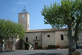 The church of Usclas-d'Hérault | |
 Coat of arms | |
show Location of Usclas-d'Hérault | |
 Usclas-d'Hérault | |
| Coordinates: 43°31′10″N 3°27′54″E / 43.5194°N 3.465°ECoordinates: 43°31′10″N 3°27′54″E / 43.5194°N 3.465°E | |
| Country | France |
| Region | Occitanie |
| Department | Hérault |
| Arrondissement | Lodève |
| Canton | Mèze |
| Intercommunality | Clermontais |
| Government | |
| • Mayor (2008–2014) | Bernard Foulquier-Gazagnes |
| Area 1 | 2.82 km2 (1.09 sq mi) |
| Population (Jan. 2018)[1] | 425 |
| • Density | 150/km2 (390/sq mi) |
| Time zone | UTC+01:00 (CET) |
| • Summer (DST) | UTC+02:00 (CEST) |
| INSEE/Postal code | 34315 /34230 |
| Elevation | 18–30 m (59–98 ft) (avg. 24 m or 79 ft) |
| 1 French Land Register data, which excludes lakes, ponds, glaciers > 1 km2 (0.386 sq mi or 247 acres) and river estuaries. | |


Usclas-d'Hérault (Occitan: Usclats d'Erau) is a commune in the Hérault department in the Occitanie region in southern France.
Population[]
| Year | Pop. | ±% |
|---|---|---|
| 1962 | 163 | — |
| 1968 | 166 | +1.8% |
| 1975 | 129 | −22.3% |
| 1982 | 134 | +3.9% |
| 1990 | 147 | +9.7% |
| 1999 | 144 | −2.0% |
| 2008 | 271 | +88.2% |
See also[]
References[]
- ^ "Populations légales 2018". INSEE. 28 December 2020.
| Wikimedia Commons has media related to Usclas-d'Hérault. |
This Hérault geographical article is a stub. You can help Wikipedia by . |
Categories:
- Communes of Hérault
- Hérault geography stubs