Camplong
Camplong | |
|---|---|
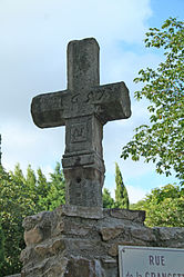 The cross of 1657 | |
show Location of Camplong | |
 Camplong | |
| Coordinates: 43°40′25″N 3°07′09″E / 43.6736°N 3.1192°ECoordinates: 43°40′25″N 3°07′09″E / 43.6736°N 3.1192°E | |
| Country | France |
| Region | Occitanie |
| Department | Hérault |
| Arrondissement | Béziers |
| Canton | Clermont-l'Hérault |
| Government | |
| • Mayor (2020–2026) | Bernard Coste[1] |
| Area 1 | 13.25 km2 (5.12 sq mi) |
| Population (Jan. 2018)[2] | 232 |
| • Density | 18/km2 (45/sq mi) |
| Time zone | UTC+01:00 (CET) |
| • Summer (DST) | UTC+02:00 (CEST) |
| INSEE/Postal code | 34049 /34260 |
| Elevation | 264–882 m (866–2,894 ft) (avg. 247 m or 810 ft) |
| 1 French Land Register data, which excludes lakes, ponds, glaciers > 1 km2 (0.386 sq mi or 247 acres) and river estuaries. | |


Camplong is a commune in the Hérault department in southern France.

Map
Personalities[]
- Ferdinand Fabre spent part of his youth at the house of his uncle, who was curate of the parish.
Population[]
| Year | Pop. | ±% |
|---|---|---|
| 1881 | 1,685 | — |
| 1891 | 1,902 | +12.9% |
| 1901 | 600 | −68.5% |
| 1911 | 574 | −4.3% |
| 1921 | 546 | −4.9% |
| 1931 | 614 | +12.5% |
| 1936 | 596 | −2.9% |
| 1954 | 615 | +3.2% |
| 1962 | 182 | −70.4% |
| 1968 | 348 | +91.2% |
| 1975 | 305 | −12.4% |
| 1982 | 251 | −17.7% |
| 1990 | 241 | −4.0% |
| 1999 | 187 | −22.4% |
| 2008 | 236 | +26.2% |
See also[]
References[]
- ^ "Répertoire national des élus: les maires". data.gouv.fr, Plateforme ouverte des données publiques françaises (in French). 2 December 2020.
- ^ "Populations légales 2018". INSEE. 28 December 2020.
| Wikimedia Commons has media related to Camplong (Hérault). |
This Hérault geographical article is a stub. You can help Wikipedia by . |
Categories:
- Communes of Hérault
- Hérault geography stubs