Saint-Mathieu-de-Tréviers
Saint-Mathieu-de-Tréviers | |
|---|---|
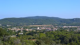 A general view of Saint-Mathieu-de-Tréviers | |
 Coat of arms | |
show Location of Saint-Mathieu-de-Tréviers | |
 Saint-Mathieu-de-Tréviers | |
| Coordinates: 43°46′14″N 3°52′10″E / 43.7706°N 3.8694°ECoordinates: 43°46′14″N 3°52′10″E / 43.7706°N 3.8694°E | |
| Country | France |
| Region | Occitanie |
| Department | Hérault |
| Arrondissement | Lodève |
| Canton | Saint-Gély-du-Fesc |
| Intercommunality | Grand Pic Saint-Loup |
| Government | |
| • Mayor (2020–2026) | Jerôme Lopez |
| Area 1 | 21.92 km2 (8.46 sq mi) |
| Population (Jan. 2018)[1] | 4,836 |
| • Density | 220/km2 (570/sq mi) |
| Time zone | UTC+01:00 (CET) |
| • Summer (DST) | UTC+02:00 (CEST) |
| INSEE/Postal code | 34276 /34270 |
| Elevation | 78–400 m (256–1,312 ft) (avg. 81 m or 266 ft) |
| 1 French Land Register data, which excludes lakes, ponds, glaciers > 1 km2 (0.386 sq mi or 247 acres) and river estuaries. | |


Saint-Mathieu-de-Tréviers (French pronunciation: [sɛ̃ matjø də tʁevje]; Occitan: Sant Matieu de Trevièrs) is a commune in the Hérault department in the Occitanie region in southern France.
Population[]
| Year | Pop. | ±% |
|---|---|---|
| 1962 | 534 | — |
| 1968 | 571 | +6.9% |
| 1975 | 954 | +67.1% |
| 1982 | 1,505 | +57.8% |
| 1990 | 2,623 | +74.3% |
| 1999 | 3,713 | +41.6% |
| 2008 | 4,660 | +25.5% |
See also[]
References[]
- ^ "Populations légales 2018". INSEE. 28 December 2020.
| Wikimedia Commons has media related to Saint-Mathieu-de-Tréviers. |
| show Authority control |
|---|
This Hérault geographical article is a stub. You can help Wikipedia by . |
Categories:
- Communes of Hérault
- Hérault geography stubs