Montesquieu, Hérault
Montesquieu | |
|---|---|
 Coat of arms | |
show Location of Montesquieu | |
 Montesquieu | |
| Coordinates: 43°33′45″N 3°16′36″E / 43.5625°N 3.2767°ECoordinates: 43°33′45″N 3°16′36″E / 43.5625°N 3.2767°E | |
| Country | France |
| Region | Occitanie |
| Department | Hérault |
| Arrondissement | Béziers |
| Canton | Cazouls-lès-Béziers |
| Intercommunality | CC Les Avant-Monts |
| Government | |
| • Mayor (2008–2014) | Elie Kubica |
| Area 1 | 14.47 km2 (5.59 sq mi) |
| Population (Jan. 2018)[1] | 73 |
| • Density | 5.0/km2 (13/sq mi) |
| Time zone | UTC+01:00 (CET) |
| • Summer (DST) | UTC+02:00 (CEST) |
| INSEE/Postal code | 34168 /34320 |
| Elevation | 140–467 m (459–1,532 ft) (avg. 150 m or 490 ft) |
| 1 French Land Register data, which excludes lakes, ponds, glaciers > 1 km2 (0.386 sq mi or 247 acres) and river estuaries. | |


Montesquieu (Languedocien: Montesquiu) is a commune in the Hérault department in the Occitanie region in southern France.
Geography[]
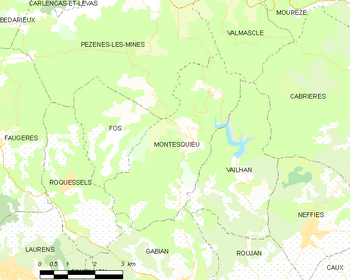
Map
The original village of Montesquieu is in ruins. The commune has a number of hamlets: Mas Rolland, which has the town hall and the old school, Paders, near the valley of the Peyne, Fournols to the north of the commune and Valuzières towards the middle.
Population[]
| Year | Pop. | ±% |
|---|---|---|
| 1962 | 45 | — |
| 1968 | 53 | +17.8% |
| 1975 | 35 | −34.0% |
| 1982 | 38 | +8.6% |
| 1990 | 47 | +23.7% |
| 1999 | 47 | +0.0% |
| 2008 | 60 | +27.7% |
See also[]
References[]
- ^ "Populations légales 2018". INSEE. 28 December 2020.
| Wikimedia Commons has media related to Montesquieu (Hérault). |
This Hérault geographical article is a stub. You can help Wikipedia by . |
Categories:
- Communes of Hérault
- Hérault geography stubs