Montels, Hérault
Montels | |
|---|---|
 Coat of arms | |
show Location of Montels | |
 Montels | |
| Coordinates: 43°17′44″N 3°01′51″E / 43.2956°N 3.0308°ECoordinates: 43°17′44″N 3°01′51″E / 43.2956°N 3.0308°E | |
| Country | France |
| Region | Occitanie |
| Department | Hérault |
| Arrondissement | Béziers |
| Canton | Saint-Pons-de-Thomières |
| Government | |
| • Mayor (2008–2014) | André Frances |
| Area 1 | 7.3 km2 (2.8 sq mi) |
| Population (Jan. 2018)[1] | 253 |
| • Density | 35/km2 (90/sq mi) |
| Time zone | UTC+01:00 (CET) |
| • Summer (DST) | UTC+02:00 (CEST) |
| INSEE/Postal code | 34167 /34310 |
| Elevation | 0–24 m (0–79 ft) (avg. 11 m or 36 ft) |
| 1 French Land Register data, which excludes lakes, ponds, glaciers > 1 km2 (0.386 sq mi or 247 acres) and river estuaries. | |


Montels is a commune in the Hérault department in the Occitanie region in southern France.
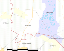
Map
Population[]
| Year | Pop. | ±% |
|---|---|---|
| 1962 | 133 | — |
| 1968 | 140 | +5.3% |
| 1975 | 127 | −9.3% |
| 1982 | 123 | −3.1% |
| 1990 | 134 | +8.9% |
| 1999 | 168 | +25.4% |
| 2008 | 230 | +36.9% |
See also[]
References[]
- ^ "Populations légales 2018". INSEE. 28 December 2020.
| Wikimedia Commons has media related to Montels (Hérault). |
This Hérault geographical article is a stub. You can help Wikipedia by . |
Categories:
- Communes of Hérault
- Hérault geography stubs