Cambon-et-Salvergues
Cambon-et-Salvergues | |
|---|---|
 Salvergues | |
 Coat of arms | |
show Location of Cambon-et-Salvergues | |
 Cambon-et-Salvergues | |
| Coordinates: 43°37′08″N 2°51′33″E / 43.6189°N 2.8592°ECoordinates: 43°37′08″N 2°51′33″E / 43.6189°N 2.8592°E | |
| Country | France |
| Region | Occitanie |
| Department | Hérault |
| Arrondissement | Béziers |
| Canton | Saint-Pons-de-Thomières |
| Government | |
| • Mayor (2020–2026) | Marie Casares[1] |
| Area 1 | 50.39 km2 (19.46 sq mi) |
| Population (Jan. 2018)[2] | 49 |
| • Density | 0.97/km2 (2.5/sq mi) |
| Time zone | UTC+01:00 (CET) |
| • Summer (DST) | UTC+02:00 (CEST) |
| INSEE/Postal code | 34046 /34330 |
| Elevation | 511–1,152 m (1,677–3,780 ft) (avg. 1,000 m or 3,300 ft) |
| 1 French Land Register data, which excludes lakes, ponds, glaciers > 1 km2 (0.386 sq mi or 247 acres) and river estuaries. | |


Cambon-et-Salvergues (French pronunciation: [kɑ̃bɔ̃ e salvɛʁɡ]; Occitan: Cambon e Salvèrgas) is a commune in the Hérault department in southern France.
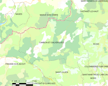
Map
Population[]
| Year | Pop. | ±% |
|---|---|---|
| 1962 | 105 | — |
| 1968 | 120 | +14.3% |
| 1975 | 94 | −21.7% |
| 1982 | 77 | −18.1% |
| 1990 | 69 | −10.4% |
| 1999 | 74 | +7.2% |
| 2008 | 72 | −2.7% |
See also[]
References[]
- ^ "Répertoire national des élus: les maires". data.gouv.fr, Plateforme ouverte des données publiques françaises (in French). 2 December 2020.
- ^ "Populations légales 2018". INSEE. 28 December 2020.
| Wikimedia Commons has media related to Cambon-et-Salvergues. |
This Hérault geographical article is a stub. You can help Wikipedia by . |
Categories:
- Communes of Hérault
- Hérault geography stubs