Murviel-lès-Montpellier
Murviel-lès-Montpellier | |
|---|---|
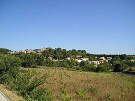 A general view of Murviel-lès-Montpellier | |
 Coat of arms | |
show Location of Murviel-lès-Montpellier | |
 Murviel-lès-Montpellier | |
| Coordinates: 43°36′19″N 3°44′15″E / 43.6053°N 3.7375°ECoordinates: 43°36′19″N 3°44′15″E / 43.6053°N 3.7375°E | |
| Country | France |
| Region | Occitanie |
| Department | Hérault |
| Arrondissement | Montpellier |
| Canton | Pignan |
| Intercommunality | Montpellier Méditerranée Métropole |
| Government | |
| • Mayor (2020–2026) | Isabelle Touzard |
| Area 1 | 10.11 km2 (3.90 sq mi) |
| Population (Jan. 2018)[1] | 1,873 |
| • Density | 190/km2 (480/sq mi) |
| Time zone | UTC+01:00 (CET) |
| • Summer (DST) | UTC+02:00 (CEST) |
| INSEE/Postal code | 34179 /34570 |
| Elevation | 66–236 m (217–774 ft) (avg. 150 m or 490 ft) |
| 1 French Land Register data, which excludes lakes, ponds, glaciers > 1 km2 (0.386 sq mi or 247 acres) and river estuaries. | |


Murviel-lès-Montpellier (French pronunciation: [myʁvjɛl lɛ mɔ̃pəlje], literally Murviel near Montpellier; Occitan: Mervièlh) is a commune in the Hérault department in the Occitanie region in southern France.
The Oppidum d’Altimurium, also known as the Oppidum Murviel-les-Montpellier, is an ancient hill-town (or oppidum) located near the village.
Agénor Azéma de Montgravier, pioneering archaeologist, carried out excavations in the mid 19th century at the Roman ruins of Murviel-lès-Montpellier on behalf of the Commission de la Carte des Gaules. An archaeological museum with some artifacts from the site is located in Murviel-les-Montpellier.
Population[]
| Year | Pop. | ±% |
|---|---|---|
| 1962 | 390 | — |
| 1968 | 424 | +8.7% |
| 1975 | 441 | +4.0% |
| 1982 | 687 | +55.8% |
| 1990 | 935 | +36.1% |
| 1999 | 1,208 | +29.2% |
| 2008 | 1,749 | +44.8% |

Romanesque polygonal apse of Saint-Jean-Baptiste church
See also[]
References[]
- ^ "Populations légales 2018". INSEE. 28 December 2020.
| Wikimedia Commons has media related to Murviel-lès-Montpellier. |
| show Authority control |
|---|
This Hérault geographical article is a stub. You can help Wikipedia by . |
Categories:
- Communes of Hérault
- Hérault geography stubs