Cabrerolles
Cabrerolles | |
|---|---|
 Coat of arms | |
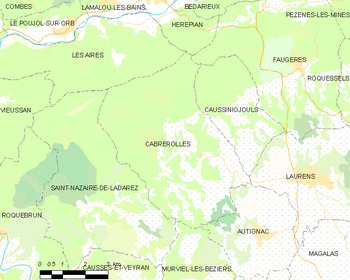
show Location of Cabrerolles | |
 Cabrerolles | |
| Coordinates: 43°32′45″N 3°07′34″E / 43.5458°N 3.1261°ECoordinates: 43°32′45″N 3°07′34″E / 43.5458°N 3.1261°E | |
| Country | France |
| Region | Occitanie |
| Department | Hérault |
| Arrondissement | Béziers |
| Canton | Cazouls-lès-Béziers |
| Intercommunality | Les Avant-Monts |
| Government | |
| • Mayor (2020–2026) | Séverine Saur |
| Area 1 | 28.68 km2 (11.07 sq mi) |
| Population (Jan. 2018)[1] | 338 |
| • Density | 12/km2 (31/sq mi) |
| Time zone | UTC+01:00 (CET) |
| • Summer (DST) | UTC+02:00 (CEST) |
| INSEE/Postal code | 34044 /34480 |
| Elevation | 134–705 m (440–2,313 ft) (avg. 310 m or 1,020 ft) |
| 1 French Land Register data, which excludes lakes, ponds, glaciers > 1 km2 (0.386 sq mi or 247 acres) and river estuaries. | |


Cabrerolles (French pronunciation: [kabʁəʁɔl]; Languedocien: Cabrairòlas) is a commune in the Hérault department in southern France.
Winemaking[]
Cabrerolles is one of the seven communes which produces Faugères AOC wine. As well as the main village, it has three hamlets, Lentheric, Liquière and Aigues-Vives, which all produce wine.
Population[]
| Year | Pop. | ±% |
|---|---|---|
| 2004 | 297 | — |
| 2006 | 324 | +9.1% |
| 2007 | 334 | +3.1% |
| 2008 | 345 | +3.3% |
| 2009 | 355 | +2.9% |
| 2010 | 363 | +2.3% |
| 2011 | 358 | −1.4% |
| 2012 | 349 | −2.5% |
| 2013 | 339 | −2.9% |
| 2014 | 330 | −2.7% |
| 2015 | 331 | +0.3% |
| 2016 | 332 | +0.3% |
Map
See also[]
References[]
- ^ "Populations légales 2018". INSEE. 28 December 2020.
| Wikimedia Commons has media related to Cabrerolles. |
This Hérault geographical article is a stub. You can help Wikipedia by . |
Categories:
- Communes of Hérault
- Hérault geography stubs