Cers, Hérault
Cers | |
|---|---|
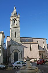 Church St-Genies | |
 Coat of arms | |
show Location of Cers | |
 Cers | |
| Coordinates: 43°19′27″N 3°18′19″E / 43.3242°N 3.3053°ECoordinates: 43°19′27″N 3°18′19″E / 43.3242°N 3.3053°E | |
| Country | France |
| Region | Occitanie |
| Department | Hérault |
| Arrondissement | Béziers |
| Canton | Béziers-3 |
| Intercommunality | CA Béziers Méditerranée |
| Government | |
| • Mayor (2020–2026) | Didier Bresson |
| Area 1 | 7.85 km2 (3.03 sq mi) |
| Population (Jan. 2018)[1] | 2,564 |
| • Density | 330/km2 (850/sq mi) |
| Time zone | UTC+01:00 (CET) |
| • Summer (DST) | UTC+02:00 (CEST) |
| INSEE/Postal code | 34073 /34420 |
| Elevation | 3–48 m (9.8–157.5 ft) (avg. 15 m or 49 ft) |
| 1 French Land Register data, which excludes lakes, ponds, glaciers > 1 km2 (0.386 sq mi or 247 acres) and river estuaries. | |


Map
Cers (French pronunciation: [sɛʁs]; Occitan: Cèrç) is a commune in the Hérault department in southern France.
Population[]
| Year | Pop. | ±% |
|---|---|---|
| 1962 | 595 | — |
| 1968 | 666 | +11.9% |
| 1975 | 840 | +26.1% |
| 1982 | 1,350 | +60.7% |
| 1990 | 1,798 | +33.2% |
| 1999 | 1,802 | +0.2% |
| 2008 | 2,215 | +22.9% |
See also[]
References[]
- ^ "Populations légales 2018". INSEE. 28 December 2020.
| Wikimedia Commons has media related to Cers. |
| show Authority control |
|---|
This Hérault geographical article is a stub. You can help Wikipedia by . |
Categories:
- Communes of Hérault
- Hérault geography stubs