Montoulieu, Hérault
Montoulieu | |
|---|---|
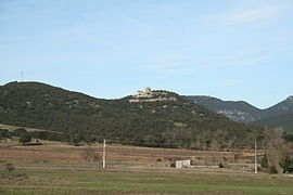 Chateau | |
 Coat of arms | |
show Location of Montoulieu | |
 Montoulieu | |
| Coordinates: 43°55′41″N 3°47′29″E / 43.9281°N 3.7914°ECoordinates: 43°55′41″N 3°47′29″E / 43.9281°N 3.7914°E | |
| Country | France |
| Region | Occitanie |
| Department | Hérault |
| Arrondissement | Lodève |
| Canton | Lodève |
| Intercommunality | Cévennes Gangeoises et Suménoises |
| Government | |
| • Mayor (2020–2026) | Guilhem Chafiol[1] |
| Area 1 | 16.1 km2 (6.2 sq mi) |
| Population (Jan. 2018)[2] | 162 |
| • Density | 10/km2 (26/sq mi) |
| Time zone | UTC+01:00 (CET) |
| • Summer (DST) | UTC+02:00 (CEST) |
| INSEE/Postal code | 34171 /34190 |
| Elevation | 159–522 m (522–1,713 ft) (avg. 180 m or 590 ft) |
| 1 French Land Register data, which excludes lakes, ponds, glaciers > 1 km2 (0.386 sq mi or 247 acres) and river estuaries. | |


Montoulieu (French pronunciation: [mɔ̃tuljø]; Occitan: Montoliu) is a commune in the Hérault department in the Occitanie region in southern France.
Population[]
| Year | Pop. | ±% |
|---|---|---|
| 1962 | 46 | — |
| 1968 | 70 | +52.2% |
| 1975 | 39 | −44.3% |
| 1982 | 61 | +56.4% |
| 1990 | 87 | +42.6% |
| 1999 | 115 | +32.2% |
| 2008 | 146 | +27.0% |
See also[]
References[]
- ^ "Répertoire national des élus: les maires". data.gouv.fr, Plateforme ouverte des données publiques françaises (in French). 2 December 2020.
- ^ "Populations légales 2018". INSEE. 28 December 2020.
| Wikimedia Commons has media related to Montoulieu (Hérault). |
This Hérault geographical article is a stub. You can help Wikipedia by . |
Categories:
- Communes of Hérault
- Hérault geography stubs