Chartres-de-Bretagne
show This article may be expanded with text translated from the corresponding article in French. (November 2015) Click [show] for important translation instructions. |
Chartres-de-Bretagne
Karnod | |
|---|---|
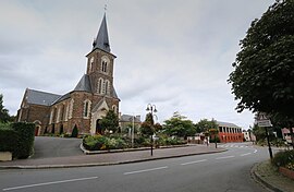 Notre Dame church | |
 Coat of arms | |
show Location of Chartres-de-Bretagne | |
 Chartres-de-Bretagne | |
| Coordinates: 48°02′25″N 1°42′10″W / 48.0403°N 1.7028°WCoordinates: 48°02′25″N 1°42′10″W / 48.0403°N 1.7028°W | |
| Country | France |
| Region | Brittany |
| Department | Ille-et-Vilaine |
| Arrondissement | Rennes |
| Canton | Bruz |
| Intercommunality | Rennes Métropole |
| Government | |
| • Mayor (2020–2026) | Philippe Bonnin[1] |
| Area 1 | 9.95 km2 (3.84 sq mi) |
| Population (Jan. 2018)[2] | 8,023 |
| • Density | 810/km2 (2,100/sq mi) |
| Time zone | UTC+01:00 (CET) |
| • Summer (DST) | UTC+02:00 (CEST) |
| INSEE/Postal code | 35066 /35131 |
| Elevation | 16–50 m (52–164 ft) |
| 1 French Land Register data, which excludes lakes, ponds, glaciers > 1 km2 (0.386 sq mi or 247 acres) and river estuaries. | |


Chartres-de-Bretagne (French pronunciation: [ʃaʁtʁ də bʁətaɲ]; Breton: Karnod, Gallo: Chartr) is a commune in the Ille-et-Vilaine department of Brittany in northwestern France.
Inhabitants of Chartres-de-Bretagne are called Chartrains in French.
Population[]
|
|
See also[]
- Communes of the Ille-et-Vilaine department
- Emmanuel Guérin Sculptor Chartres-de-Bretagne war memorial
References[]
- ^ "Répertoire national des élus: les maires". data.gouv.fr, Plateforme ouverte des données publiques françaises (in French). 2 December 2020.
- ^ "Populations légales 2018". INSEE. 28 December 2020.
External links[]
| Wikimedia Commons has media related to Chartres-de-Bretagne. |
- Official website (in French)
- Base Mérimée: Search for heritage in the commune, Ministère français de la Culture. (in French)
- Mayors of Ille-et-Vilaine Association (in French)
| show Communes of the Ille-et-Vilaine department |
|---|
This Ille-et-Vilaine geographical article is a stub. You can help Wikipedia by . |
Categories:
- Communes of Ille-et-Vilaine
- Ille-et-Vilaine geography stubs