Montgermont
Montgermont
Menezgervant | |
|---|---|
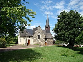 The church of Montgermont | |
 Coat of arms | |
show Location of Montgermont | |
 Montgermont | |
| Coordinates: 48°09′27″N 1°42′54″W / 48.1575°N 1.7150°WCoordinates: 48°09′27″N 1°42′54″W / 48.1575°N 1.7150°W | |
| Country | France |
| Region | Brittany |
| Department | Ille-et-Vilaine |
| Arrondissement | Rennes |
| Canton | Betton |
| Intercommunality | Rennes Métropole |
| Government | |
| • Mayor (2014–2020) | Brigitte Le Men |
| Area 1 | 4.67 km2 (1.80 sq mi) |
| Population (Jan. 2018)[1] | 3,440 |
| • Density | 740/km2 (1,900/sq mi) |
| Time zone | UTC+01:00 (CET) |
| • Summer (DST) | UTC+02:00 (CEST) |
| INSEE/Postal code | 35189 /35760 |
| Elevation | 34–62 m (112–203 ft) |
| 1 French Land Register data, which excludes lakes, ponds, glaciers > 1 km2 (0.386 sq mi or 247 acres) and river estuaries. | |


Montgermont (Breton: Menezgervant, Gallo: Monjèrmont) is a commune in the Ille-et-Vilaine department of Brittany in northwestern France.
Population[]
Inhabitants of Montgermont are called in French Montgermontais.
| Year | Pop. | ±% |
|---|---|---|
| 1962 | 455 | — |
| 1968 | 606 | +33.2% |
| 1975 | 1,099 | +81.4% |
| 1982 | 1,976 | +79.8% |
| 1990 | 2,395 | +21.2% |
| 1999 | 2,758 | +15.2% |
| 2008 | 3,039 | +10.2% |
See also[]
- Communes of the Ille-et-Vilaine department
References[]
- ^ "Populations légales 2018". INSEE. 28 December 2020.
External links[]
| Wikimedia Commons has media related to Montgermont. |
- Official website (in French)
- Base Mérimée: Search for heritage in the commune, Ministère français de la Culture. (in French)
- Mayors of Ille-et-Vilaine Association (in French)
| show Communes of the Ille-et-Vilaine department |
|---|
| show Authority control |
|---|
This Ille-et-Vilaine geographical article is a stub. You can help Wikipedia by . |
Categories:
- Communes of Ille-et-Vilaine
- Ille-et-Vilaine geography stubs