Bertric-Burée
Bertric-Burée | |
|---|---|
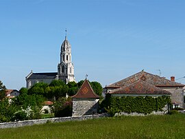 A general view of Bertric-Burée | |
show Location of Bertric-Burée | |
 Bertric-Burée | |
| Coordinates: 45°18′21″N 0°21′29″E / 45.3058°N 0.3581°ECoordinates: 45°18′21″N 0°21′29″E / 45.3058°N 0.3581°E | |
| Country | France |
| Region | Nouvelle-Aquitaine |
| Department | Dordogne |
| Arrondissement | Périgueux |
| Canton | Ribérac |
| Government | |
| • Mayor (2020–2026) | Jean-Pierre Prigul |
| Area 1 | 16.73 km2 (6.46 sq mi) |
| Population (Jan. 2018)[1] | 430 |
| • Density | 26/km2 (67/sq mi) |
| Time zone | UTC+01:00 (CET) |
| • Summer (DST) | UTC+02:00 (CEST) |
| INSEE/Postal code | 24038 /24320 |
| Elevation | 68–181 m (223–594 ft) (avg. 174 m or 571 ft) |
| 1 French Land Register data, which excludes lakes, ponds, glaciers > 1 km2 (0.386 sq mi or 247 acres) and river estuaries. | |


Bertric-Burée (French pronunciation: [bɛʁtʁik byʁe]; Occitan: Bertric e Burèia) is a commune in the Dordogne department in southwestern France.
Population[]
| Year | Pop. | ±% |
|---|---|---|
| 1962 | 360 | — |
| 1968 | 330 | −8.3% |
| 1975 | 308 | −6.7% |
| 1982 | 314 | +1.9% |
| 1990 | 340 | +8.3% |
| 1999 | 393 | +15.6% |
| 2008 | 409 | +4.1% |
See also[]
References[]
- ^ "Populations légales 2018". INSEE. 28 December 2020.
| Wikimedia Commons has media related to Bertric-Burée. |
This Dordogne geographical article is a stub. You can help Wikipedia by . |
Categories:
- Communes of Dordogne
- Dordogne geography stubs