Piégut-Pluviers
Piégut-Pluviers | |
|---|---|
 Town hall | |
 Coat of arms | |
show Location of Piégut-Pluviers | |
 Piégut-Pluviers | |
| Coordinates: 45°37′25″N 0°41′25″E / 45.6236°N 0.6903°ECoordinates: 45°37′25″N 0°41′25″E / 45.6236°N 0.6903°E | |
| Country | France |
| Region | Nouvelle-Aquitaine |
| Department | Dordogne |
| Arrondissement | Nontron |
| Canton | Périgord Vert Nontronnais |
| Intercommunality | Périgord Nontronnais |
| Government | |
| • Mayor (2008–2014) | Didier Vignal |
| Area 1 | 18.11 km2 (6.99 sq mi) |
| Population (Jan. 2018)[1] | 1,171 |
| • Density | 65/km2 (170/sq mi) |
| Time zone | UTC+01:00 (CET) |
| • Summer (DST) | UTC+02:00 (CEST) |
| INSEE/Postal code | 24328 /24360 |
| Elevation | 216–310 m (709–1,017 ft) |
| 1 French Land Register data, which excludes lakes, ponds, glaciers > 1 km2 (0.386 sq mi or 247 acres) and river estuaries. | |


Piégut-Pluviers is a commune in the Dordogne department in Nouvelle-Aquitaine in southwestern France. The commune is located 45 km (28 mi) from Angoulême, 65 km (40 mi) from Périgueux and Limoges and 200 km (120 mi) from Bordeaux.
Population[]
| Year | Pop. | ±% |
|---|---|---|
| 1962 | 1,532 | — |
| 1968 | 1,545 | +0.8% |
| 1975 | 1,504 | −2.7% |
| 1982 | 1,527 | +1.5% |
| 1990 | 1,471 | −3.7% |
| 1999 | 1,313 | −10.7% |
| 2008 | 1,216 | −7.4% |
History[]
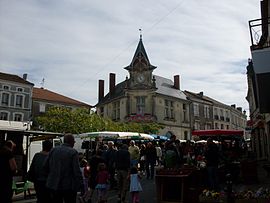
In Gallo-Roman times the place was called Podium Acutum. The castle was destroyed by Richard Lionheart in 1199, only the tower is still to be seen. The market on Wednesday morning has been held here since the seventeenth century.

Tower of Piégut
See also[]
References[]
- ^ "Populations légales 2018". INSEE. 28 December 2020.
| Wikimedia Commons has media related to Piégut-Pluviers. |
| show Authority control |
|---|
This Dordogne geographical article is a stub. You can help Wikipedia by . |
Categories:
- Communes of Dordogne
- Dordogne geography stubs