Sainte-Radegonde, Dordogne
Sainte-Radegonde | |
|---|---|
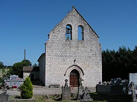 The church in Sainte-Radegonde | |
 Coat of arms | |
show Location of Sainte-Radegonde | |
 Sainte-Radegonde | |
| Coordinates: 44°41′29″N 0°40′45″E / 44.6914°N 0.6792°ECoordinates: 44°41′29″N 0°40′45″E / 44.6914°N 0.6792°E | |
| Country | France |
| Region | Nouvelle-Aquitaine |
| Department | Dordogne |
| Arrondissement | Bergerac |
| Canton | Sud-Bergeracois |
| Government | |
| • Mayor (2020–2026) | Michel Coassin |
| Area 1 | 4.81 km2 (1.86 sq mi) |
| Population (Jan. 2018)[1] | 62 |
| • Density | 13/km2 (33/sq mi) |
| Time zone | UTC+01:00 (CET) |
| • Summer (DST) | UTC+02:00 (CEST) |
| INSEE/Postal code | 24492 /24560 |
| Elevation | 72–113 m (236–371 ft) (avg. 100 m or 330 ft) |
| 1 French Land Register data, which excludes lakes, ponds, glaciers > 1 km2 (0.386 sq mi or 247 acres) and river estuaries. | |


Sainte-Radegonde (French pronunciation: [sɛ̃t ʁadɡɔ̃d]; Languedocien: Senta Radegonda) is a commune in the Dordogne department in Nouvelle-Aquitaine in southwestern France.
Population[]
| Year | Pop. | ±% |
|---|---|---|
| 1962 | 115 | — |
| 1968 | 95 | −17.4% |
| 1975 | 71 | −25.3% |
| 1982 | 86 | +21.1% |
| 1990 | 76 | −11.6% |
| 1999 | 64 | −15.8% |
| 2008 | 55 | −14.1% |
See also[]
References[]
- ^ "Populations légales 2018". INSEE. 28 December 2020.
| Wikimedia Commons has media related to Sainte-Radegonde (Dordogne). |
This Dordogne geographical article is a stub. You can help Wikipedia by . |
Categories:
- Communes of Dordogne
- Dordogne geography stubs