Saint-Étienne-de-Puycorbier
Saint-Étienne-de-Puycorbier | |
|---|---|
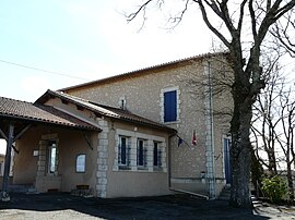 The town hall in Saint-Étienne-de-Puycorbier | |
show Location of Saint-Étienne-de-Puycorbier | |
 Saint-Étienne-de-Puycorbier | |
| Coordinates: 45°05′37″N 0°19′50″E / 45.0936°N 0.3306°ECoordinates: 45°05′37″N 0°19′50″E / 45.0936°N 0.3306°E | |
| Country | France |
| Region | Nouvelle-Aquitaine |
| Department | Dordogne |
| Arrondissement | Périgueux |
| Canton | Vallée de l'Isle |
| Government | |
| • Mayor (2008–2014) | Daniel Tournier |
| Area 1 | 13.54 km2 (5.23 sq mi) |
| Population (Jan. 2018)[1] | 106 |
| • Density | 7.8/km2 (20/sq mi) |
| Time zone | UTC+01:00 (CET) |
| • Summer (DST) | UTC+02:00 (CEST) |
| INSEE/Postal code | 24399 /24400 |
| Elevation | 50–157 m (164–515 ft) (avg. 90 m or 300 ft) |
| 1 French Land Register data, which excludes lakes, ponds, glaciers > 1 km2 (0.386 sq mi or 247 acres) and river estuaries. | |


Saint-Étienne-de-Puycorbier (Limousin: Sent Estefe de Pueicorbier) is a commune in the Dordogne department in Nouvelle-Aquitaine in southwestern France.
Population[]
| Year | Pop. | ±% |
|---|---|---|
| 1962 | 151 | — |
| 1968 | 124 | −17.9% |
| 1975 | 99 | −20.2% |
| 1982 | 117 | +18.2% |
| 1990 | 118 | +0.9% |
| 1999 | 113 | −4.2% |
| 2008 | 102 | −9.7% |
See also[]
References[]
- ^ "Populations légales 2018". INSEE. 28 December 2020.
| Wikimedia Commons has media related to Saint-Étienne-de-Puycorbier. |
| show Authority control |
|---|
This Dordogne geographical article is a stub. You can help Wikipedia by . |
Categories:
- Communes of Dordogne
- Dordogne geography stubs