Mescoules
show This article may be expanded with text translated from the corresponding article in French. (July 2014) Click [show] for important translation instructions. |
Mescoules | |
|---|---|
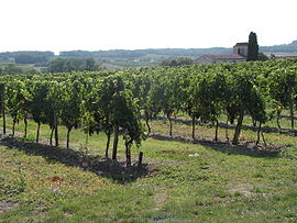 Vineyard and the church of Mescoules | |
show Location of Mescoules | |
 Mescoules | |
| Coordinates: 44°44′44″N 0°25′56″E / 44.7456°N 0.4322°ECoordinates: 44°44′44″N 0°25′56″E / 44.7456°N 0.4322°E | |
| Country | France |
| Region | Nouvelle-Aquitaine |
| Department | Dordogne |
| Arrondissement | Bergerac |
| Canton | Sud-Bergeracois |
| Government | |
| • Mayor (2008–2014) | Roger Lapouge |
| Area 1 | 4.85 km2 (1.87 sq mi) |
| Population (Jan. 2018)[1] | 179 |
| • Density | 37/km2 (96/sq mi) |
| Time zone | UTC+01:00 (CET) |
| • Summer (DST) | UTC+02:00 (CEST) |
| INSEE/Postal code | 24267 /24240 |
| Elevation | 83–166 m (272–545 ft) (avg. 120 m or 390 ft) |
| 1 French Land Register data, which excludes lakes, ponds, glaciers > 1 km2 (0.386 sq mi or 247 acres) and river estuaries. | |


Mescoules (French pronunciation: [mɛskul]; Occitan: Mescola) is a commune in the Dordogne department in Nouvelle-Aquitaine in southwestern France.
Population[]
| Year | Pop. | ±% |
|---|---|---|
| 1962 | 180 | — |
| 1968 | 155 | −13.9% |
| 1975 | 150 | −3.2% |
| 1982 | 135 | −10.0% |
| 1990 | 144 | +6.7% |
| 1999 | 141 | −2.1% |
| 2008 | 159 | +12.8% |
See also[]
References[]
- ^ "Populations légales 2018". INSEE. 28 December 2020.
| Wikimedia Commons has media related to Mescoules. |
This Dordogne geographical article is a stub. You can help Wikipedia by . |
Categories:
- Communes of Dordogne
- Dordogne geography stubs