Monsaguel
Monsaguel | |
|---|---|
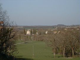 A general view of Monsaguel | |
show Location of Monsaguel | |
 Monsaguel | |
| Coordinates: 44°44′18″N 0°34′52″E / 44.7383°N 0.5811°ECoordinates: 44°44′18″N 0°34′52″E / 44.7383°N 0.5811°E | |
| Country | France |
| Region | Nouvelle-Aquitaine |
| Department | Dordogne |
| Arrondissement | Bergerac |
| Canton | Sud-Bergeracois |
| Government | |
| • Mayor (2020–2026) | Hervé Delage |
| Area 1 | 11.57 km2 (4.47 sq mi) |
| Population (Jan. 2018)[1] | 149 |
| • Density | 13/km2 (33/sq mi) |
| Time zone | UTC+01:00 (CET) |
| • Summer (DST) | UTC+02:00 (CEST) |
| INSEE/Postal code | 24282 /24560 |
| Elevation | 62–173 m (203–568 ft) (avg. 111 m or 364 ft) |
| 1 French Land Register data, which excludes lakes, ponds, glaciers > 1 km2 (0.386 sq mi or 247 acres) and river estuaries. | |


Monsaguel (French pronunciation: [mɔ̃saɡɛl]; Occitan: Monsaguèl) is a commune in the Dordogne department in Nouvelle-Aquitaine in southwestern France.
Population[]
| Year | Pop. | ±% |
|---|---|---|
| 1962 | 155 | — |
| 1968 | 114 | −26.5% |
| 1975 | 92 | −19.3% |
| 1982 | 113 | +22.8% |
| 1990 | 125 | +10.6% |
| 1999 | 134 | +7.2% |
| 2008 | 153 | +14.2% |
See also[]
References[]
- ^ "Populations légales 2018". INSEE. 28 December 2020.
| Wikimedia Commons has media related to Monsaguel. |
This Dordogne geographical article is a stub. You can help Wikipedia by . |
Categories:
- Communes of Dordogne
- Dordogne geography stubs