Nailhac
Nailhac | |
|---|---|
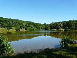 Etang du coucou | |
show Location of Nailhac | |
 Nailhac | |
| Coordinates: 45°13′40″N 1°09′12″E / 45.2278°N 1.1533°ECoordinates: 45°13′40″N 1°09′12″E / 45.2278°N 1.1533°E | |
| Country | France |
| Region | Nouvelle-Aquitaine |
| Department | Dordogne |
| Arrondissement | Sarlat-la-Canéda |
| Canton | Haut-Périgord Noir |
| Intercommunality | |
| Government | |
| • Mayor (2020–2026) | Francis Aumettre[1] |
| Area 1 | 19.35 km2 (7.47 sq mi) |
| Population (Jan. 2018)[2] | 321 |
| • Density | 17/km2 (43/sq mi) |
| Time zone | UTC+01:00 (CET) |
| • Summer (DST) | UTC+02:00 (CEST) |
| INSEE/Postal code | 24302 /24390 |
| Elevation | 161–357 m (528–1,171 ft) (avg. 225 m or 738 ft) |
| 1 French Land Register data, which excludes lakes, ponds, glaciers > 1 km2 (0.386 sq mi or 247 acres) and river estuaries. | |


Nailhac (French pronunciation: [najak]; Occitan: Nalhac) is a commune in the Dordogne department in Nouvelle-Aquitaine in southwestern France.
Population[]
| Year | Pop. | ±% |
|---|---|---|
| 2005 | 271 | — |
| 2006 | 274 | +1.1% |
| 2007 | 277 | +1.1% |
| 2008 | 284 | +2.5% |
| 2009 | 290 | +2.1% |
| 2010 | 297 | +2.4% |
| 2011 | 295 | −0.7% |
| 2012 | 298 | +1.0% |
| 2013 | 306 | +2.7% |
| 2014 | 314 | +2.6% |
| 2015 | 322 | +2.5% |
| 2016 | 325 | +0.9% |
See also[]
References[]
- ^ "Répertoire national des élus: les maires". data.gouv.fr, Plateforme ouverte des données publiques françaises (in French). 2 December 2020.
- ^ "Populations légales 2018". INSEE. 28 December 2020.
| Wikimedia Commons has media related to Nailhac. |
This Dordogne geographical article is a stub. You can help Wikipedia by . |
Categories:
- Communes of Dordogne
- Dordogne geography stubs