Saint-Léon-sur-Vézère
From Wikipedia, the free encyclopedia
Commune in Nouvelle-Aquitaine, France
Saint-Léon-sur-Vézère | |
|---|---|
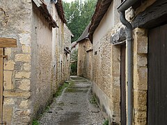
 The high street in Saint-Léon-sur-Vézère | |
 Coat of arms | |
 Saint-Léon-sur-Vézère  Saint-Léon-sur-Vézère | |
Coordinates:  45°00′41″N 1°05′22″E / 45.0114°N 1.0894°E / 45.0114; 1.0894Coordinates: 45°00′41″N 1°05′22″E / 45.0114°N 1.0894°E / 45.0114; 1.0894 45°00′41″N 1°05′22″E / 45.0114°N 1.0894°E / 45.0114; 1.0894Coordinates: 45°00′41″N 1°05′22″E / 45.0114°N 1.0894°E / 45.0114; 1.0894 | |
| Country | France |
| Region | Nouvelle-Aquitaine |
| Department | Dordogne |
| Arrondissement | Sarlat-la-Canéda |
| Canton | Vallée de l'Homme |
| Government | |
| • Mayor (2008–2014) | François Bruno |
| Area 1 | 13.76 km2 (5.31 sq mi) |
| Population (Jan. 2018)[1] | 421 |
| • Density | 31/km2 (79/sq mi) |
| Time zone | UTC+01:00 (CET) |
| • Summer (DST) | UTC+02:00 (CEST) |
| INSEE/Postal code | 24443 /24290 |
| Elevation | 62–260 m (203–853 ft) (avg. 70 m or 230 ft) |
| 1 French Land Register data, which excludes lakes, ponds, glaciers > 1 km2 (0.386 sq mi or 247 acres) and river estuaries. | |

Saint-Léon-sur-Vézère (Occitan: Sent Leu de Vesera) is a commune in the Dordogne department in Nouvelle-Aquitaine in southwestern France.
Contents
Population[]
| Year | Pop. | ±% |
|---|---|---|
| 1962 | 319 | — |
| 1968 | 345 | +8.2% |
| 1975 | 334 | −3.2% |
| 1982 | 390 | +16.8% |
| 1990 | 427 | +9.5% |
| 1999 | 419 | −1.9% |
| 2008 | 433 | +3.3% |
Views[]
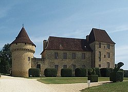
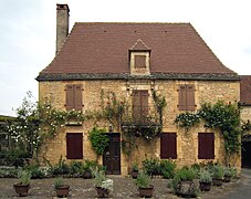
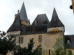
- Views of Saint-Léon-sur-Vézère


See also[]
References[]
- ^ "Populations légales 2018". INSEE. 28 December 2020.
| Wikimedia Commons has media related to Saint-Léon-sur-Vézère. |
show
Villages in the association Les Plus Beaux Villages de France | |
|---|---|
| Auvergne-Rhône-Alpes |
|
| Bourgogne-Franche-Comté |
|
| Brittany |
|
| Centre-Val de Loire |
|
| Corsica |
|
| Grand Est |
|
| Hauts-de-France |
|
| Île-de-France |
|
| Normandy |
|
| Nouvelle-Aquitaine |
|
| Occitanie |
|
| Pays de la Loire |
|
| Provence-Alpes-Côte d'Azur |
|
| Réunion | |
| show Authority control | |
|---|---|
| General |
|
| National libraries | |
This Dordogne geographical article is a stub. You can help Wikipedia by . |
- v
- t
Retrieved from ""
Categories:
- Communes of Dordogne
- Plus Beaux Villages de France
- Dordogne geography stubs
Hidden categories:
- Articles with short description
- Short description is different from Wikidata
- Infobox mapframe without OSM relation ID on Wikidata
- Coordinates on Wikidata
- Pages using infobox settlement with image map1 but not image map
- Articles containing Occitan (post 1500)-language text
- Commons category link is on Wikidata
- Articles with VIAF identifiers
- Articles with BNF identifiers
- Articles with WorldCat-VIAF identifiers
- All stub articles
- Pages using the Kartographer extension