Monmadalès
Monmadalès | |
|---|---|
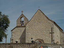 The church in Monmadalès | |
show Location of Monmadalès | |
 Monmadalès | |
| Coordinates: 44°46′00″N 0°37′23″E / 44.7667°N 0.6231°ECoordinates: 44°46′00″N 0°37′23″E / 44.7667°N 0.6231°E | |
| Country | France |
| Region | Nouvelle-Aquitaine |
| Department | Dordogne |
| Arrondissement | Bergerac |
| Canton | Sud-Bergeracois |
| Government | |
| • Mayor (2008–2014) | Michel Raynal |
| Area 1 | 5.04 km2 (1.95 sq mi) |
| Population (Jan. 2018)[1] | 82 |
| • Density | 16/km2 (42/sq mi) |
| Time zone | UTC+01:00 (CET) |
| • Summer (DST) | UTC+02:00 (CEST) |
| INSEE/Postal code | 24278 /24560 |
| Elevation | 74–138 m (243–453 ft) (avg. 136 m or 446 ft) |
| 1 French Land Register data, which excludes lakes, ponds, glaciers > 1 km2 (0.386 sq mi or 247 acres) and river estuaries. | |


Monmadalès is a commune in the Dordogne department in Nouvelle-Aquitaine in southwestern France.
Population[]
| Year | Pop. | ±% |
|---|---|---|
| 1962 | 83 | — |
| 1968 | 64 | −22.9% |
| 1975 | 81 | +26.6% |
| 1982 | 58 | −28.4% |
| 1990 | 52 | −10.3% |
| 1999 | 73 | +40.4% |
| 2008 | 70 | −4.1% |
See also[]
References[]
- ^ "Populations légales 2018". INSEE. 28 December 2020.
| Wikimedia Commons has media related to Monmadalès. |
This Dordogne geographical article is a stub. You can help Wikipedia by . |
Categories:
- Communes of Dordogne
- Dordogne geography stubs