Cunèges
Cunèges | |
|---|---|
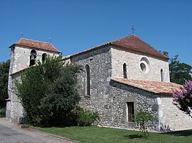 The church in Cunèges | |
show Location of Cunèges | |
 Cunèges | |
| Coordinates: 44°46′51″N 0°22′24″E / 44.7808°N 0.3733°ECoordinates: 44°46′51″N 0°22′24″E / 44.7808°N 0.3733°E | |
| Country | France |
| Region | Nouvelle-Aquitaine |
| Department | Dordogne |
| Arrondissement | Bergerac |
| Canton | Sud-Bergeracois |
| Government | |
| • Mayor (2020–2026) | Sylvie Rivière |
| Area 1 | 5.98 km2 (2.31 sq mi) |
| Population (Jan. 2018)[1] | 289 |
| • Density | 48/km2 (130/sq mi) |
| Time zone | UTC+01:00 (CET) |
| • Summer (DST) | UTC+02:00 (CEST) |
| INSEE/Postal code | 24148 /24240 |
| Elevation | 36–128 m (118–420 ft) (avg. 87 m or 285 ft) |
| 1 French Land Register data, which excludes lakes, ponds, glaciers > 1 km2 (0.386 sq mi or 247 acres) and river estuaries. | |


Cunèges (French pronunciation: [kynɛʒ]; Occitan: Cunèja) is a commune in the Dordogne department in Nouvelle-Aquitaine in southwestern France.
Population[]
| Year | Pop. | ±% |
|---|---|---|
| 1962 | 249 | — |
| 1968 | 214 | −14.1% |
| 1975 | 194 | −9.3% |
| 1982 | 206 | +6.2% |
| 1990 | 201 | −2.4% |
| 1999 | 255 | +26.9% |
| 2008 | 317 | +24.3% |
See also[]
References[]
- ^ "Populations légales 2018". INSEE. 28 December 2020.
| Wikimedia Commons has media related to Cunèges. |
| Authority control |
|
|---|
This Dordogne geographical article is a stub. You can help Wikipedia by . |
Categories:
- Communes of Dordogne
- Dordogne geography stubs