Jaure
Jaure | |
|---|---|
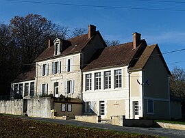 The town hall in Jaure | |
show Location of Jaure | |
 Jaure | |
| Coordinates: 45°03′27″N 0°33′17″E / 45.0575°N 0.5547°ECoordinates: 45°03′27″N 0°33′17″E / 45.0575°N 0.5547°E | |
| Country | France |
| Region | Nouvelle-Aquitaine |
| Department | Dordogne |
| Arrondissement | Périgueux |
| Canton | Saint-Astier |
| Government | |
| • Mayor (2020–2026) | Philippe de Séverac |
| Area 1 | 7.54 km2 (2.91 sq mi) |
| Population (Jan. 2018)[1] | 170 |
| • Density | 23/km2 (58/sq mi) |
| Time zone | UTC+01:00 (CET) |
| • Summer (DST) | UTC+02:00 (CEST) |
| INSEE/Postal code | 24213 /24140 |
| Elevation | 93–221 m (305–725 ft) (avg. 141 m or 463 ft) |
| 1 French Land Register data, which excludes lakes, ponds, glaciers > 1 km2 (0.386 sq mi or 247 acres) and river estuaries. | |


Jaure (French pronunciation: [ʒɔʁ]) is a commune in the Dordogne department in Nouvelle-Aquitaine in southwestern France.
Population[]
| Year | Pop. | ±% |
|---|---|---|
| 1962 | 160 | — |
| 1968 | 140 | −12.5% |
| 1975 | 124 | −11.4% |
| 1982 | 158 | +27.4% |
| 1990 | 143 | −9.5% |
| 1999 | 140 | −2.1% |
| 2008 | 145 | +3.6% |
See also[]
References[]
- ^ "Populations légales 2018". INSEE. 28 December 2020.
| Wikimedia Commons has media related to Jaure. |
This Dordogne geographical article is a stub. You can help Wikipedia by . |
Categories:
- Communes of Dordogne
- Dordogne geography stubs