Saint-Louis-en-l'Isle
Saint-Louis-en-l'Isle | |
|---|---|
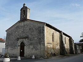 The church in Saint-Louis-en-l'Isle | |
 Coat of arms | |
show Location of Saint-Louis-en-l'Isle | |
 Saint-Louis-en-l'Isle | |
| Coordinates: 45°03′41″N 0°23′32″E / 45.0614°N 0.3922°ECoordinates: 45°03′41″N 0°23′32″E / 45.0614°N 0.3922°E | |
| Country | France |
| Region | Nouvelle-Aquitaine |
| Department | Dordogne |
| Arrondissement | Périgueux |
| Canton | Vallée de l'Isle |
| Government | |
| • Mayor (2020–2026) | Jean-Luc Massias |
| Area 1 | 2.82 km2 (1.09 sq mi) |
| Population (Jan. 2018)[1] | 303 |
| • Density | 110/km2 (280/sq mi) |
| Time zone | UTC+01:00 (CET) |
| • Summer (DST) | UTC+02:00 (CEST) |
| INSEE/Postal code | 24444 /24400 |
| Elevation | 43–127 m (141–417 ft) (avg. 58 m or 190 ft) |
| 1 French Land Register data, which excludes lakes, ponds, glaciers > 1 km2 (0.386 sq mi or 247 acres) and river estuaries. | |


Saint-Louis-en-l'Isle (French pronunciation: [sɛ̃ lwi ɑ̃ lil]; Limousin: Sent Loís d'Eila) is a commune in the Dordogne department in Nouvelle-Aquitaine in southwestern France.
Population[]
| Year | Pop. | ±% |
|---|---|---|
| 1962 | 209 | — |
| 1968 | 204 | −2.4% |
| 1975 | 241 | +18.1% |
| 1982 | 220 | −8.7% |
| 1990 | 233 | +5.9% |
| 1999 | 224 | −3.9% |
| 2008 | 253 | +12.9% |
See also[]
References[]
- ^ "Populations légales 2018". INSEE. 28 December 2020.
| Wikimedia Commons has media related to Saint-Louis-en-l'Isle. |
| show Authority control |
|---|
This Dordogne geographical article is a stub. You can help Wikipedia by . |
Categories:
- Communes of Dordogne
- Dordogne geography stubs