Celles, Dordogne
Celles | |
|---|---|
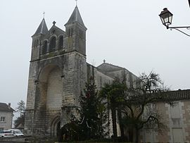 The church in Celles | |
show Location of Celles | |
 Celles | |
| Coordinates: 45°17′51″N 0°24′47″E / 45.2975°N 0.4131°ECoordinates: 45°17′51″N 0°24′47″E / 45.2975°N 0.4131°E | |
| Country | France |
| Region | Nouvelle-Aquitaine |
| Department | Dordogne |
| Arrondissement | Périgueux |
| Canton | Ribérac |
| Government | |
| • Mayor (2020–2026) | Jean-Didier Andrieux[1] |
| Area 1 | 27.83 km2 (10.75 sq mi) |
| Population (Jan. 2018)[2] | 587 |
| • Density | 21/km2 (55/sq mi) |
| Time zone | UTC+01:00 (CET) |
| • Summer (DST) | UTC+02:00 (CEST) |
| INSEE/Postal code | 24090 /24600 |
| Elevation | 61–213 m (200–699 ft) (avg. 91 m or 299 ft) |
| 1 French Land Register data, which excludes lakes, ponds, glaciers > 1 km2 (0.386 sq mi or 247 acres) and river estuaries. | |


Celles is a commune in the Dordogne department in Nouvelle-Aquitaine in southwestern France.
Population[]
| Year | Pop. | ±% |
|---|---|---|
| 1962 | 761 | — |
| 1968 | 675 | −11.3% |
| 1975 | 582 | −13.8% |
| 1982 | 600 | +3.1% |
| 1990 | 597 | −0.5% |
| 1999 | 552 | −7.5% |
| 2008 | 551 | −0.2% |
See also[]
References[]
- ^ "Répertoire national des élus: les maires". data.gouv.fr, Plateforme ouverte des données publiques françaises (in French). 2 December 2020.
- ^ "Populations légales 2018". INSEE. 28 December 2020.
| Wikimedia Commons has media related to Celles (Dordogne). |
This Dordogne geographical article is a stub. You can help Wikipedia by . |
Categories:
- Communes of Dordogne
- Dordogne geography stubs