La Chapelle-Gonaguet
La Chapelle-Gonaguet | |
|---|---|
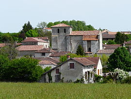 The church and surroundings in La Chapelle-Gonaguet | |
show Location of La Chapelle-Gonaguet | |
 La Chapelle-Gonaguet | |
| Coordinates: 45°13′53″N 0°36′50″E / 45.2314°N 0.6139°ECoordinates: 45°13′53″N 0°36′50″E / 45.2314°N 0.6139°E | |
| Country | France |
| Region | Nouvelle-Aquitaine |
| Department | Dordogne |
| Arrondissement | Périgueux |
| Canton | Saint-Astier |
| Intercommunality | Le Grand Périgueux |
| Government | |
| • Mayor (2020–2026) | Franck-Moissat |
| Area 1 | 19.07 km2 (7.36 sq mi) |
| Population (Jan. 2018)[1] | 1,064 |
| • Density | 56/km2 (140/sq mi) |
| Time zone | UTC+01:00 (CET) |
| • Summer (DST) | UTC+02:00 (CEST) |
| INSEE/Postal code | 24108 /24350 |
| Elevation | 95–233 m (312–764 ft) (avg. 179 m or 587 ft) |
| 1 French Land Register data, which excludes lakes, ponds, glaciers > 1 km2 (0.386 sq mi or 247 acres) and river estuaries. | |


La Chapelle-Gonaguet (French pronunciation: [la ʃapɛl ɡɔnaɡɛ]; Occitan: La Chapela de Gonaguet) is a commune in the Dordogne department in Nouvelle-Aquitaine in southwestern France.
Population[]
|
|
See also[]
References[]
- ^ "Populations légales 2018". INSEE. 28 December 2020.
| Wikimedia Commons has media related to La Chapelle-Gonaguet. |
This Dordogne geographical article is a stub. You can help Wikipedia by . |
Categories:
- Communes of Dordogne
- Dordogne geography stubs