Simeyrols
Simeyrols | |
|---|---|
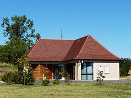 The town hall in Simeyrols | |
 Coat of arms | |
show Location of Simeyrols | |
 Simeyrols | |
| Coordinates: 44°54′28″N 1°20′23″E / 44.9078°N 1.3397°ECoordinates: 44°54′28″N 1°20′23″E / 44.9078°N 1.3397°E | |
| Country | France |
| Region | Nouvelle-Aquitaine |
| Department | Dordogne |
| Arrondissement | Sarlat-la-Canéda |
| Canton | Terrasson-Lavilledieu |
| Government | |
| • Mayor (2020–2026) | Jean-Pierre Planche |
| Area 1 | 9.26 km2 (3.58 sq mi) |
| Population (Jan. 2018)[1] | 256 |
| • Density | 28/km2 (72/sq mi) |
| Time zone | UTC+01:00 (CET) |
| • Summer (DST) | UTC+02:00 (CEST) |
| INSEE/Postal code | 24535 /24370 |
| Elevation | 134–286 m (440–938 ft) (avg. 200 m or 660 ft) |
| 1 French Land Register data, which excludes lakes, ponds, glaciers > 1 km2 (0.386 sq mi or 247 acres) and river estuaries. | |


Simeyrols is a commune in the Dordogne department in Nouvelle-Aquitaine in southwestern France.
Population[]
| Year | Pop. | ±% |
|---|---|---|
| 1962 | 153 | — |
| 1968 | 160 | +4.6% |
| 1975 | 180 | +12.5% |
| 1982 | 162 | −10.0% |
| 1990 | 185 | +14.2% |
| 1999 | 189 | +2.2% |
| 2004 | 199 | +5.3% |
| 2009 | 235 | +18.1% |
| 2014 | 250 | +6.4% |
| 2018 | 256 | +2.4% |
See also[]
References[]
- ^ "Populations légales 2018". INSEE. 28 December 2020.
| Wikimedia Commons has media related to Simeyrols. |
This Dordogne geographical article is a stub. You can help Wikipedia by . |
Categories:
- Communes of Dordogne
- Dordogne geography stubs