Firbeix
Firbeix | |
|---|---|
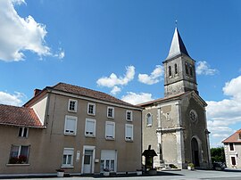 The church in Firbeix | |
show Location of Firbeix | |
 Firbeix | |
| Coordinates: 45°36′01″N 0°58′33″E / 45.6003°N 0.9758°ECoordinates: 45°36′01″N 0°58′33″E / 45.6003°N 0.9758°E | |
| Country | France |
| Region | Nouvelle-Aquitaine |
| Department | Dordogne |
| Arrondissement | Nontron |
| Canton | Thiviers |
| Government | |
| • Mayor (2008–2014) | Christian Gorre |
| Area 1 | 22.66 km2 (8.75 sq mi) |
| Population (Jan. 2018)[1] | 312 |
| • Density | 14/km2 (36/sq mi) |
| Time zone | UTC+01:00 (CET) |
| • Summer (DST) | UTC+02:00 (CEST) |
| INSEE/Postal code | 24180 /24450 |
| Elevation | 290–451 m (951–1,480 ft) (avg. 360 m or 1,180 ft) |
| 1 French Land Register data, which excludes lakes, ponds, glaciers > 1 km2 (0.386 sq mi or 247 acres) and river estuaries. | |


Firbeix is a commune in the Dordogne department in Nouvelle-Aquitaine in southwestern France.
Geography[]
The Côle has its source near le Châtenet, a hamlet in the southern part of the commune; it forms part of the commune's southeastern border.
Population[]
| Year | Pop. | ±% |
|---|---|---|
| 1962 | 553 | — |
| 1968 | 510 | −7.8% |
| 1975 | 448 | −12.2% |
| 1982 | 401 | −10.5% |
| 1990 | 364 | −9.2% |
| 1999 | 322 | −11.5% |
| 2008 | 331 | +2.8% |
See also[]
References[]
- ^ "Populations légales 2018". INSEE. 28 December 2020.
| Wikimedia Commons has media related to Firbeix. |
This Dordogne geographical article is a stub. You can help Wikipedia by . |
Categories:
- Communes of Dordogne
- Dordogne geography stubs