Saint-Avit-Rivière
Saint-Avit-Rivière | |
|---|---|
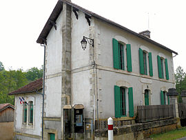 The town hall in Saint-Avit-Rivière | |
show Location of Saint-Avit-Rivière | |
 Saint-Avit-Rivière | |
| Coordinates: 44°45′10″N 0°53′03″E / 44.7527°N 0.8842°ECoordinates: 44°45′10″N 0°53′03″E / 44.7527°N 0.8842°E | |
| Country | France |
| Region | Nouvelle-Aquitaine |
| Department | Dordogne |
| Arrondissement | Bergerac |
| Canton | Lalinde |
| Government | |
| • Mayor (2020–2026) | Isabelle Mucha[1] |
| Area 1 | 14 km2 (5 sq mi) |
| Population (Jan. 2018)[2] | 80 |
| • Density | 5.7/km2 (15/sq mi) |
| Time zone | UTC+01:00 (CET) |
| • Summer (DST) | UTC+02:00 (CEST) |
| INSEE/Postal code | 24378 /24540 |
| Elevation | 101–251 m (331–823 ft) (avg. 120 m or 390 ft) |
| 1 French Land Register data, which excludes lakes, ponds, glaciers > 1 km2 (0.386 sq mi or 247 acres) and river estuaries. | |


Saint-Avit-Rivière (French pronunciation: [sɛ̃.t‿avi ʁivjɛʁ]; Occitan: Sench Avit de Ribièra) is a commune in the Dordogne department in Nouvelle-Aquitaine in southwestern France.
Population[]
| Year | Pop. | ±% |
|---|---|---|
| 1962 | 117 | — |
| 1968 | 102 | −12.8% |
| 1975 | 69 | −32.4% |
| 1982 | 71 | +2.9% |
| 1990 | 78 | +9.9% |
| 1999 | 73 | −6.4% |
| 2008 | 80 | +9.6% |
See also[]
References[]
- ^ "Répertoire national des élus: les maires". data.gouv.fr, Plateforme ouverte des données publiques françaises (in French). 2 December 2020. Retrieved 7 December 2020.
- ^ "Populations légales 2018". INSEE. 28 December 2020.
| Wikimedia Commons has media related to Saint-Avit-Rivière. |
This Dordogne geographical article is a stub. You can help Wikipedia by . |
Categories:
- Communes of Dordogne
- Dordogne geography stubs