Ligescourt
Ligescourt | |
|---|---|
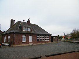 The town hall and school in Ligescourt | |
show Location of Ligescourt | |
 Ligescourt | |
| Coordinates: 50°17′23″N 1°52′36″E / 50.2897°N 1.8767°ECoordinates: 50°17′23″N 1°52′36″E / 50.2897°N 1.8767°E | |
| Country | France |
| Region | Hauts-de-France |
| Department | Somme |
| Arrondissement | Abbeville |
| Canton | Rue |
| Intercommunality | Ponthieu-Marquenterre |
| Government | |
| • Mayor (2020-2026) | Pascal Bourlo |
| Area 1 | 5.12 km2 (1.98 sq mi) |
| Population (Jan. 2018)[1] | 220 |
| • Density | 43/km2 (110/sq mi) |
| Time zone | UTC+01:00 (CET) |
| • Summer (DST) | UTC+02:00 (CEST) |
| INSEE/Postal code | 80477 /80150 |
| Elevation | 42–74 m (138–243 ft) (avg. 78 m or 256 ft) |
| 1 French Land Register data, which excludes lakes, ponds, glaciers > 1 km2 (0.386 sq mi or 247 acres) and river estuaries. | |


Ligescourt is a commune in the Somme department in Hauts-de-France in northern France.
Geography[]
Ligescourt is situated on the D12 road, some 14 miles (23 km) north of Abbeville.
Population[]
| Year | Pop. | ±% |
|---|---|---|
| 2006 | 222 | — |
| 2007 | 226 | +1.8% |
| 2008 | 228 | +0.9% |
| 2009 | 230 | +0.9% |
| 2010 | 230 | +0.0% |
| 2011 | 231 | +0.4% |
| 2012 | 231 | +0.0% |
| 2013 | 229 | −0.9% |
| 2014 | 229 | +0.0% |
| 2015 | 226 | −1.3% |
| 2016 | 222 | −1.8% |
| 2017 | 219 | −1.4% |
Politics[]
Presidential Elections Second Round:[2]
| Election | Winning Candidate | Party | % | |
|---|---|---|---|---|
| 2017 | Marine Le Pen | FN | 57.05 | |
| 2012 | François Hollande | PS | 58.22 | |
| 2007 | Nicolas Sarkozy | UMP | 54.66 | |
| 2002 | Jacques Chirac | RPR | 71.72 | |
See also[]
References[]
- ^ "Populations légales 2018". INSEE. 28 December 2020.
- ^ http://www.lemonde.fr/data/france/presidentielle-2017/
| Wikimedia Commons has media related to Ligescourt. |
Categories:
- Communes of Somme (department)
- Abbeville arrondissement geography stubs