Hamelet
From Wikipedia, the free encyclopedia
Commune in Hauts-de-France, France
Hamelet | |
|---|---|
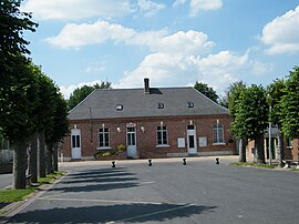 The town hall in Hamelet | |
 Hamelet  Hamelet | |
Coordinates:  49°54′22″N 2°31′46″E / 49.9061°N 2.5294°E / 49.9061; 2.5294Coordinates: 49°54′22″N 2°31′46″E / 49.9061°N 2.5294°E / 49.9061; 2.5294 49°54′22″N 2°31′46″E / 49.9061°N 2.5294°E / 49.9061; 2.5294Coordinates: 49°54′22″N 2°31′46″E / 49.9061°N 2.5294°E / 49.9061; 2.5294 | |
| Country | France |
| Region | Hauts-de-France |
| Department | Somme |
| Arrondissement | Amiens |
| Canton | Corbie |
| Intercommunality | Val de Somme |
| Government | |
| • Mayor (2020–2026) | Patrick Petit[1] |
| Area 1 | 5.93 km2 (2.29 sq mi) |
| Population (Jan. 2018)[2] | 634 |
| • Density | 110/km2 (280/sq mi) |
| Time zone | UTC+01:00 (CET) |
| • Summer (DST) | UTC+02:00 (CEST) |
| INSEE/Postal code | 80412 /80800 |
| Elevation | 28–107 m (92–351 ft) (avg. 60 m or 200 ft) |
| 1 French Land Register data, which excludes lakes, ponds, glaciers > 1 km2 (0.386 sq mi or 247 acres) and river estuaries. | |

Hamelet is a commune in the Somme department in Hauts-de-France in northern France.
Contents
Geography[]
Hamelet is situated on the D71 road, some 12 miles (19 km) east of Amiens.
Population[]
| Year | 1962 | 1968 | 1975 | 1982 | 1990 | 1999 | 2006 |
|---|---|---|---|---|---|---|---|
| Population | 220 | 273 | 268 | 371 | 388 | 412 | 461 |
| From the year 1962 on: No double counting—residents of multiple communes (e.g. students and military personnel) are counted only once. | |||||||
See also[]
References[]
- ^ "Répertoire national des élus: les maires". data.gouv.fr, Plateforme ouverte des données publiques françaises (in French). 2 December 2020.
- ^ "Populations légales 2018". INSEE. 28 December 2020.
| Wikimedia Commons has media related to Hamelet. |
show
Communes of the Somme department | |
|---|---|
|
This Arrondissement of Amiens geographical article is a stub. You can help Wikipedia by . |
- v
- t
Retrieved from ""
Categories:
- Communes of Somme (department)
- Amiens arrondissement geography stubs
Hidden categories:
- CS1 French-language sources (fr)
- Articles with short description
- Short description is different from Wikidata
- Infobox mapframe without OSM relation ID on Wikidata
- Coordinates on Wikidata
- Pages using infobox settlement with image map1 but not image map
- Commons category link from Wikidata
- Articles with BNF identifiers
- All stub articles
- Pages using the Kartographer extension