Équancourt
From Wikipedia, the free encyclopedia
Commune in Hauts-de-France, France
Équancourt | |
|---|---|
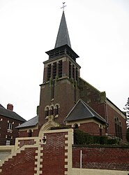 St. Martin's Church | |
 Équancourt  Équancourt | |
Coordinates:  50°02′12″N 3°01′10″E / 50.0367°N 3.0194°E / 50.0367; 3.0194Coordinates: 50°02′12″N 3°01′10″E / 50.0367°N 3.0194°E / 50.0367; 3.0194 50°02′12″N 3°01′10″E / 50.0367°N 3.0194°E / 50.0367; 3.0194Coordinates: 50°02′12″N 3°01′10″E / 50.0367°N 3.0194°E / 50.0367; 3.0194 | |
| Country | France |
| Region | Hauts-de-France |
| Department | Somme |
| Arrondissement | Péronne |
| Canton | Péronne |
| Intercommunality | Haute Somme |
| Government | |
| • Mayor (2020–2026) | Christophe Decomble |
| Area 1 | 7.79 km2 (3.01 sq mi) |
| Population (Jan. 2018)[1] | 299 |
| • Density | 38/km2 (99/sq mi) |
| Time zone | UTC+01:00 (CET) |
| • Summer (DST) | UTC+02:00 (CEST) |
| INSEE/Postal code | 80275 /80360 |
| Elevation | 88–147 m (289–482 ft) (avg. 96 m or 315 ft) |
| 1 French Land Register data, which excludes lakes, ponds, glaciers > 1 km2 (0.386 sq mi or 247 acres) and river estuaries. | |

Équancourt is a commune in the Somme department in Hauts-de-France in northern France.[2]
Contents
Geography[]
Équancourt is situated on the D58 road, some 32 km (20 mi) northwest of Saint-Quentin.
Population[]
| Year | Pop. | ±% p.a. |
|---|---|---|
| 1968 | 417 | — |
| 1975 | 326 | −3.46% |
| 1982 | 320 | −0.27% |
| 1990 | 293 | −1.10% |
| 1999 | 280 | −0.50% |
| 2007 | 316 | +1.52% |
| 2012 | 308 | −0.51% |
| 2017 | 298 | −0.66% |
| Source: INSEE[3] | ||
See also[]
References[]
- ^ "Populations légales 2018". INSEE. 28 December 2020.
- ^ Commune d'Équancourt (80275), INSEE
- ^ Population en historique depuis 1968, INSEE
| Wikimedia Commons has media related to Équancourt. |
show
Communes of the Somme department | |
|---|---|
|
This Arrondissement of Péronne geographical article is a stub. You can help Wikipedia by . |
Retrieved from ""
Categories:
- Communes of Somme (department)
- Péronne arrondissement geography stubs
Hidden categories:
- Articles with short description
- Short description is different from Wikidata
- Infobox mapframe without OSM relation ID on Wikidata
- Coordinates on Wikidata
- Pages using infobox settlement with image map1 but not image map
- Commons category link from Wikidata
- Articles with BNF identifiers
- All stub articles
- Pages using the Kartographer extension