Barly, Somme
From Wikipedia, the free encyclopedia
Commune in Hauts-de-France, France
Barly | |
|---|---|
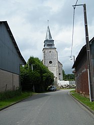 The church in Barly | |
 Barly  Barly | |
Coordinates:  50°12′10″N 2°16′29″E / 50.2028°N 2.2747°E / 50.2028; 2.2747Coordinates: 50°12′10″N 2°16′29″E / 50.2028°N 2.2747°E / 50.2028; 2.2747 50°12′10″N 2°16′29″E / 50.2028°N 2.2747°E / 50.2028; 2.2747Coordinates: 50°12′10″N 2°16′29″E / 50.2028°N 2.2747°E / 50.2028; 2.2747 | |
| Country | France |
| Region | Hauts-de-France |
| Department | Somme |
| Arrondissement | Amiens |
| Canton | Doullens |
| Intercommunality | CC Territoire Nord Picardie |
| Government | |
| • Mayor (2020–2026) | Jean-Louis Bouchez |
| Area 1 | 11.64 km2 (4.49 sq mi) |
| Population (Jan. 2018)[1] | 173 |
| • Density | 15/km2 (38/sq mi) |
| Time zone | UTC+01:00 (CET) |
| • Summer (DST) | UTC+02:00 (CEST) |
| INSEE/Postal code | 80055 /80600 |
| Elevation | 47–156 m (154–512 ft) (avg. 69 m or 226 ft) |
| 1 French Land Register data, which excludes lakes, ponds, glaciers > 1 km2 (0.386 sq mi or 247 acres) and river estuaries. | |

Barly is a commune in the Somme department in Hauts-de-France in northern France.
Contents
Geography[]
Situated halfway between Abbeville and Arras at the junction of the D59 and D196 roads and on the border of the departments of the Somme and the Pas-de-Calais.
Population[]
| Year | 1962 | 1968 | 1975 | 1982 | 1990 | 1999 | 2006 |
|---|---|---|---|---|---|---|---|
| Population | 243 | 244 | 219 | 193 | 189 | 172 | 155 |
| From the year 1962 on: No double counting—residents of multiple communes (e.g. students and military personnel) are counted only once. | |||||||
See also[]
References[]
- ^ "Populations légales 2018". INSEE. 28 December 2020.
| Wikimedia Commons has media related to Barly (Somme). |
show
Communes of the Somme department | |
|---|---|
|
This Arrondissement of Amiens geographical article is a stub. You can help Wikipedia by . |
- v
- t
Retrieved from ""
Categories:
- Communes of Somme (department)
- Amiens arrondissement geography stubs
Hidden categories:
- Articles with short description
- Short description is different from Wikidata
- Infobox mapframe without OSM relation ID on Wikidata
- Coordinates on Wikidata
- Pages using infobox settlement with image map1 but not image map
- Commons category link is on Wikidata
- Articles with BNF identifiers
- All stub articles
- Pages using the Kartographer extension