Canchy, Somme
From Wikipedia, the free encyclopedia
Commune in Hauts-de-France, France
Canchy | |
|---|---|
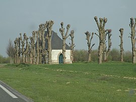 The Chapel of Notre-Dame-de-Foy in Canchy | |
 Canchy  Canchy | |
Coordinates:  50°11′14″N 1°52′42″E / 50.1872°N 1.8783°E / 50.1872; 1.8783Coordinates: 50°11′14″N 1°52′42″E / 50.1872°N 1.8783°E / 50.1872; 1.8783 50°11′14″N 1°52′42″E / 50.1872°N 1.8783°E / 50.1872; 1.8783Coordinates: 50°11′14″N 1°52′42″E / 50.1872°N 1.8783°E / 50.1872; 1.8783 | |
| Country | France |
| Region | Hauts-de-France |
| Department | Somme |
| Arrondissement | Abbeville |
| Canton | Abbeville-1 |
| Intercommunality | CC Ponthieu-Marquenterre |
| Government | |
| • Mayor (2020–2026) | Jean Grosbeau |
| Area 1 | 6.47 km2 (2.50 sq mi) |
| Population (Jan. 2018)[1] | 326 |
| • Density | 50/km2 (130/sq mi) |
| Time zone | UTC+01:00 (CET) |
| • Summer (DST) | UTC+02:00 (CEST) |
| INSEE/Postal code | 80167 /80150 |
| Elevation | 32–79 m (105–259 ft) (avg. 74 m or 243 ft) |
| 1 French Land Register data, which excludes lakes, ponds, glaciers > 1 km2 (0.386 sq mi or 247 acres) and river estuaries. | |

Canchy is a commune in the Somme department in Hauts-de-France in northern France.
There was a station on the Réseau des Bains de Mer which opened on 19 June 1892 and closed on 10 March 1947.
Contents
Geography[]
Canchy is situated just off the D928 road (it now bypasses the town), some 5 miles (8 km) north of Abbeville.
Population[]
| Year | 1962 | 1968 | 1975 | 1982 | 1990 | 1999 | 2006 |
|---|---|---|---|---|---|---|---|
| Population | 376 | 380 | 346 | 327 | 313 | 307 | 297 |
| From the year 1962 on: No double counting—residents of multiple communes (e.g. students and military personnel) are counted only once. | |||||||
See also[]
References[]
- ^ "Populations légales 2018". INSEE. 28 December 2020.
| Wikimedia Commons has media related to Canchy (Somme). |
show
Communes of the Somme department | |
|---|---|
|
This Arrondissement of Abbeville geographical article is a stub. You can help Wikipedia by . |
- v
- t
Retrieved from ""
Categories:
- Communes of Somme (department)
- Abbeville arrondissement geography stubs
Hidden categories:
- Articles with short description
- Short description is different from Wikidata
- Infobox mapframe without OSM relation ID on Wikidata
- Coordinates on Wikidata
- Pages using infobox settlement with image map1 but not image map
- Commons category link is on Wikidata
- Articles with BNF identifiers
- All stub articles
- Pages using the Kartographer extension