Rosières-en-Santerre
Rosières-en-Santerre | |
|---|---|
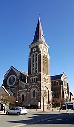 The church in Rosières-en-Santerre | |
 Coat of arms | |
show Location of Rosières-en-Santerre | |
 Rosières-en-Santerre | |
| Coordinates: 49°48′54″N 2°42′11″E / 49.815°N 2.7031°ECoordinates: 49°48′54″N 2°42′11″E / 49.815°N 2.7031°E | |
| Country | France |
| Region | Hauts-de-France |
| Department | Somme |
| Arrondissement | Péronne |
| Canton | Moreuil |
| Intercommunality | CC Terre de Picardie |
| Government | |
| • Mayor (2020–2026) | Françoise Maille-Barbare |
| Area 1 | 12.98 km2 (5.01 sq mi) |
| Population (Jan. 2018)[1] | 3,001 |
| • Density | 230/km2 (600/sq mi) |
| Time zone | UTC+01:00 (CET) |
| • Summer (DST) | UTC+02:00 (CEST) |
| INSEE/Postal code | 80680 /80170 |
| Elevation | 70–106 m (230–348 ft) (avg. 91 m or 299 ft) |
| 1 French Land Register data, which excludes lakes, ponds, glaciers > 1 km2 (0.386 sq mi or 247 acres) and river estuaries. | |


Rosières-en-Santerre (French pronunciation: [ʁozjɛʁ ɑ̃ sɑ̃tɛʁ], literally Rosières in Santerre) is a commune in the Somme department in Hauts-de-France in northern France.
Geography[]
The commune is situated some 20 kilometres (12 mi) southeast of Amiens, at the junction of the D28 and D329 roads.
Population[]
| Year | Pop. | ±% p.a. |
|---|---|---|
| 1968 | 2,605 | — |
| 1975 | 2,815 | +1.11% |
| 1982 | 2,985 | +0.84% |
| 1990 | 3,107 | +0.50% |
| 1999 | 2,956 | −0.55% |
| 2007 | 2,877 | −0.34% |
| 2012 | 2,985 | +0.74% |
| 2017 | 3,008 | +0.15% |
| Source: INSEE[2] | ||
Places of interest[]

- The mairie
- The church
Twin towns[]
![]() Drochtersen, Germany since 1972
Drochtersen, Germany since 1972
See also[]
References[]
- ^ "Populations légales 2018". INSEE. 28 December 2020.
- ^ Population en historique depuis 1968, INSEE
External links[]
| Wikimedia Commons has media related to Rosières-en-Santerre. |
- Rosières-en-Santerre – Official website (in French)
| show Authority control |
|---|
Categories:
- Communes of Somme (department)
- Péronne arrondissement geography stubs