Heucourt-Croquoison
Heucourt-Croquoison | |
|---|---|
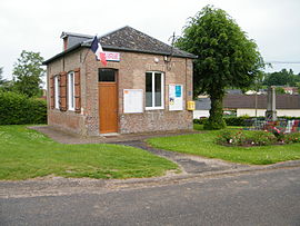 The town hall in Heucourt | |
 Coat of arms | |
show Location of Heucourt-Croquoison | |
 Heucourt-Croquoison | |
| Coordinates: 49°55′53″N 1°53′01″E / 49.9314°N 1.8836°ECoordinates: 49°55′53″N 1°53′01″E / 49.9314°N 1.8836°E | |
| Country | France |
| Region | Hauts-de-France |
| Department | Somme |
| Arrondissement | Amiens |
| Canton | Poix-de-Picardie |
| Intercommunality | CC Somme Sud-Ouest |
| Government | |
| • Mayor (2020–2026) | Florence Vaquer[1] |
| Area 1 | 5 km2 (2 sq mi) |
| Population (Jan. 2018)[2] | 112 |
| • Density | 22/km2 (58/sq mi) |
| Time zone | UTC+01:00 (CET) |
| • Summer (DST) | UTC+02:00 (CEST) |
| INSEE/Postal code | 80437 /80270 |
| Elevation | 48–129 m (157–423 ft) (avg. 80 m or 260 ft) |
| 1 French Land Register data, which excludes lakes, ponds, glaciers > 1 km2 (0.386 sq mi or 247 acres) and river estuaries. | |


Heucourt-Croquoison is a commune in the Somme department in Hauts-de-France in northern France.
Geography[]
The commune is situated on the D96 road, 26 kilometres (16 mi) south of Abbeville.
Population[]
| Year | 1962 | 1968 | 1975 | 1982 | 1990 | 1999 | 2006 |
|---|---|---|---|---|---|---|---|
| Population | 133 | 104 | 104 | 82 | 89 | 101 | 115 |
| From the year 1962 on: No double counting—residents of multiple communes (e.g. students and military personnel) are counted only once. | |||||||
See also[]
References[]
- ^ "Répertoire national des élus: les maires". data.gouv.fr, Plateforme ouverte des données publiques françaises (in French). 2 December 2020.
- ^ "Populations légales 2018". INSEE. 28 December 2020.
| Wikimedia Commons has media related to Heucourt-Croquoison. |
Categories:
- Communes of Somme (department)
- Amiens arrondissement geography stubs