Villers-sous-Ailly
From Wikipedia, the free encyclopedia
Commune in Hauts-de-France, France
Villers-sous-Ailly | |
|---|---|
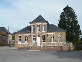 The town hall and school in Villers-sous-Ailly | |
 Villers-sous-Ailly  Villers-sous-Ailly | |
| Coordinates: 50°03′44″N 2°01′03″E / 50.0622°N 2.0175°E / 50.0622; 2.0175Coordinates: 50°03′44″N 2°01′03″E / 50.0622°N 2.0175°E / 50.0622; 2.0175 | |
| Country | France |
| Region | Hauts-de-France |
| Department | Somme |
| Arrondissement | Abbeville |
| Canton | Rue |
| Intercommunality | CC Ponthieu-Marquenterre |
| Government | |
| • Mayor (2020–2026) | Laurent Sauvage |
| Area 1 | 6.26 km2 (2.42 sq mi) |
| Population (Jan. 2018)[1] | 176 |
| • Density | 28/km2 (73/sq mi) |
| Time zone | UTC+01:00 (CET) |
| • Summer (DST) | UTC+02:00 (CEST) |
| INSEE/Postal code | 80804 /80690 |
| Elevation | 40–112 m (131–367 ft) (avg. 80 m or 260 ft) |
| 1 French Land Register data, which excludes lakes, ponds, glaciers > 1 km2 (0.386 sq mi or 247 acres) and river estuaries. | |

Villers-sous-Ailly is a commune in the Somme department in Hauts-de-France in northern France.
Contents
Geography[]
The commune is situated 8 miles(12 km) southeast of Abbeville, on the D237 road.
Population[]
| Year | 1962 | 1968 | 1975 | 1982 | 1990 | 1999 | 2006 |
|---|---|---|---|---|---|---|---|
| Population | 142 | 143 | 109 | 122 | 146 | 146 | 159 |
| From the year 1962 on: No double counting—residents of multiple communes (e.g. students and military personnel) are counted only once. | |||||||

Ech monumint à chés morts
(War memorial)
See also[]
References[]
- ^ "Populations légales 2018". INSEE. 28 December 2020.
| Wikimedia Commons has media related to Villers-sous-Ailly. |
show
Communes of the Somme department | |
|---|---|
|
This Arrondissement of Abbeville geographical article is a stub. You can help Wikipedia by . |
- v
- t
Retrieved from ""
Categories:
- Communes of Somme (department)
- Abbeville arrondissement geography stubs
Hidden categories:
- Articles with short description
- Short description is different from Wikidata
- Infobox mapframe without OSM relation ID on Wikidata
- Coordinates on Wikidata
- Pages using infobox settlement with image map1 but not image map
- Commons category link from Wikidata
- Articles with BNF identifiers
- All stub articles
- Pages using the Kartographer extension