Remaugies
From Wikipedia, the free encyclopedia
Commune in Hauts-de-France, France
Remaugies | |
|---|---|
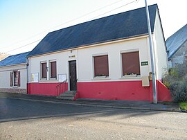 The town hall in Remaugies | |
 Remaugies  Remaugies | |
Coordinates:  49°37′43″N 2°40′02″E / 49.6286°N 2.6672°E / 49.6286; 2.6672Coordinates: 49°37′43″N 2°40′02″E / 49.6286°N 2.6672°E / 49.6286; 2.6672 49°37′43″N 2°40′02″E / 49.6286°N 2.6672°E / 49.6286; 2.6672Coordinates: 49°37′43″N 2°40′02″E / 49.6286°N 2.6672°E / 49.6286; 2.6672 | |
| Country | France |
| Region | Hauts-de-France |
| Department | Somme |
| Arrondissement | Montdidier |
| Canton | Roye |
| Intercommunality | CC Grand Roye |
| Government | |
| • Mayor (2020–2026) | Eymeric Bizet |
| Area 1 | 4.14 km2 (1.60 sq mi) |
| Population (Jan. 2018)[1] | 130 |
| • Density | 31/km2 (81/sq mi) |
| Time zone | UTC+01:00 (CET) |
| • Summer (DST) | UTC+02:00 (CEST) |
| INSEE/Postal code | 80667 /80500 |
| Elevation | 89–115 m (292–377 ft) (avg. 103 m or 338 ft) |
| 1 French Land Register data, which excludes lakes, ponds, glaciers > 1 km2 (0.386 sq mi or 247 acres) and river estuaries. | |

Remaugies (French pronunciation: [ʁəmoʒi]) is a commune in the Somme department in Hauts-de-France in northern France.
Contents
Geography[]
Situated about 36 miles (58 km) southeast of Amiens, on the D68 road
Population[]
| Year | Pop. | ±% p.a. |
|---|---|---|
| 1968 | 114 | — |
| 1975 | 89 | −3.47% |
| 1982 | 87 | −0.32% |
| 1990 | 81 | −0.89% |
| 1999 | 97 | +2.02% |
| 2007 | 115 | +2.15% |
| 2012 | 119 | +0.69% |
| 2017 | 132 | +2.10% |
| Source: INSEE[2] | ||
See also[]
References[]
- ^ "Populations légales 2018". INSEE. 28 December 2020.
- ^ Population en historique depuis 1968, INSEE
| Wikimedia Commons has media related to Remaugies. |
show
Communes of the Somme department | |
|---|---|
|
This Arrondissement of Montdidier geographical article is a stub. You can help Wikipedia by . |
- v
- t
Retrieved from ""
Categories:
- Communes of Somme (department)
- Montdidier arrondissement geography stubs
Hidden categories:
- Articles with short description
- Short description is different from Wikidata
- Infobox mapframe without OSM relation ID on Wikidata
- Coordinates on Wikidata
- Pages using infobox settlement with image map1 but not image map
- Commons category link from Wikidata
- Articles with BNF identifiers
- All stub articles
- Pages using the Kartographer extension