Warvillers
From Wikipedia, the free encyclopedia
Commune in Hauts-de-France, France
Warvillers | |
|---|---|
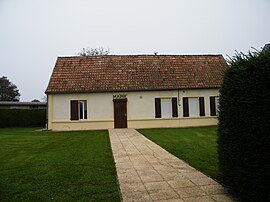 The town hall in Warvillers | |
 Warvillers  Warvillers | |
Coordinates:  49°46′50″N 2°41′16″E / 49.7806°N 2.6878°E / 49.7806; 2.6878Coordinates: 49°46′50″N 2°41′16″E / 49.7806°N 2.6878°E / 49.7806; 2.6878 49°46′50″N 2°41′16″E / 49.7806°N 2.6878°E / 49.7806; 2.6878Coordinates: 49°46′50″N 2°41′16″E / 49.7806°N 2.6878°E / 49.7806; 2.6878 | |
| Country | France |
| Region | Hauts-de-France |
| Department | Somme |
| Arrondissement | Péronne |
| Canton | Moreuil |
| Intercommunality | Terre de Picardie |
| Government | |
| • Mayor (2020–2026) | Jean de Lamarlière |
| Area 1 | 4.18 km2 (1.61 sq mi) |
| Population (Jan. 2018)[1] | 142 |
| • Density | 34/km2 (88/sq mi) |
| Time zone | UTC+01:00 (CET) |
| • Summer (DST) | UTC+02:00 (CEST) |
| INSEE/Postal code | 80823 /80170 |
| Elevation | 92–99 m (302–325 ft) (avg. 100 m or 330 ft) |
| 1 French Land Register data, which excludes lakes, ponds, glaciers > 1 km2 (0.386 sq mi or 247 acres) and river estuaries. | |

Warvillers is a commune in the Somme department in Hauts-de-France in northern France.
Contents
Geography[]
Warvillers is situated 21 miles(33 km) southeast of Amiens, on the D329 road
Population[]
| Year | Pop. | ±% |
|---|---|---|
| 2006 | 121 | — |
| 2007 | 121 | +0.0% |
| 2008 | 126 | +4.1% |
| 2009 | 130 | +3.2% |
| 2010 | 135 | +3.8% |
| 2011 | 136 | +0.7% |
| 2012 | 139 | +2.2% |
| 2013 | 142 | +2.2% |
| 2014 | 144 | +1.4% |
| 2015 | 147 | +2.1% |
| 2016 | 147 | +0.0% |
See also[]
References[]
- ^ "Populations légales 2018". INSEE. 28 December 2020.
| Wikimedia Commons has media related to Warvillers. |
show
Communes of the Somme department | |
|---|---|
|
This Arrondissement of Péronne geographical article is a stub. You can help Wikipedia by . |
Retrieved from ""
Categories:
- Communes of Somme (department)
- Péronne arrondissement geography stubs
Hidden categories:
- Articles with short description
- Short description is different from Wikidata
- Infobox mapframe without OSM relation ID on Wikidata
- Coordinates on Wikidata
- Pages using infobox settlement with image map1 but not image map
- Commons category link from Wikidata
- Articles with BNF identifiers
- All stub articles
- Pages using the Kartographer extension